
Lêer:Europe at the death of Theoderic the Great in 526.jpg
Grootte van hierdie voorskou: 800 × 570 piksels. Ander resolusies: 320 × 228 piksels | 640 × 456 piksels | 1 024 × 729 piksels | 1 280 × 911 piksels | 2 754 × 1 961 piksels.
Oorspronklike lêer (2 754 × 1 961 piksels, lêergrootte: 3,71 MG, MIME-tipe: image/jpeg)
Opsomming
| Beskrywing |
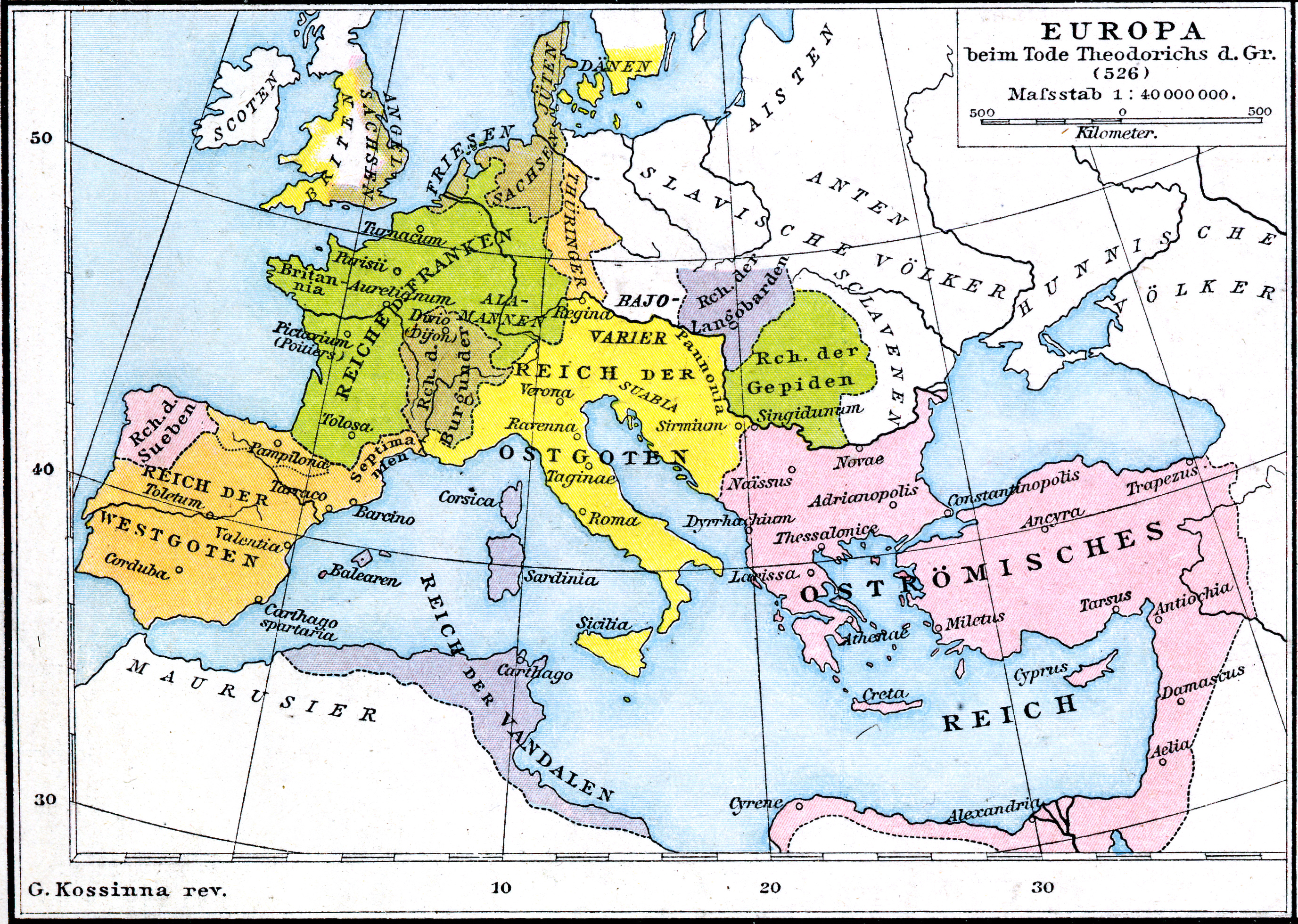
English: Third map (of four) from plate 19 of Professor G. Droysen's Allgemeiner Historischer Handatlas, published by R. Andrée. Plate is titled "Europa zur Zeit der Völkerwanderung". This map is titled "Europa beim Tode Theoderichs d. Gr. (526) |
| Datum | |
| Bron | Allgemeiner Historischer Handatlas |
| Outeur | Droysen/Andrée; G. Kossina rev. |
Lisensiëring
|
This work is in the public domain in its country of origin and other countries and areas where the copyright term is the author's life plus 100 years or fewer. This work is in the public domain in the United States because it was published (or registered with the U.S. Copyright Office) before January 1, 1929. | |
| Hierdie lêer is geïdentifiseer as vry van bekende beperkings onder kopiereg, insluitend alle verwante en naburige regte. | |
Lêergeskiedenis
Klik op die datum/tyd om te sien hoe die lêer destyds gelyk het.
| Datum/Tyd | Duimnael | Dimensies | Gebruiker | Opmerking | |
|---|---|---|---|---|---|
| huidig | 06:55, 12 September 2015 | | 2 754 × 1 961 (3,71 MG) | Чръный человек | осветление |
| 22:54, 31 Augustus 2011 |  | 2 754 × 1 961 (4,15 MG) | Maproom | {{Information |Description ={{en|1=Third map (of four) from plate 19 of Professor G. Droysens Allgemeiner Historischer Handatlas, published by R. Andrée.}} |Source ={{own}} |Author =Maproom |Date =Published 1 |
Lêergebruik
Die volgende bladsy gebruik dié lêer:
Globale lêergebruik
Die volgende ander wiki's gebruik hierdie lêer:
- Gebruik in ar.wikipedia.org
- Gebruik in azb.wikipedia.org
- Gebruik in ca.wikipedia.org
- Gebruik in de.wikipedia.org
- Gebruik in en.wikipedia.org
- Gebruik in es.wikipedia.org
- Gebruik in ru.wikipedia.org
- Gebruik in sw.wikipedia.org
- Gebruik in uk.wikipedia.org