
Lêer:Location of North America.svg

Oorspronklike lêer (SVG-lêer, normaalweg 585 × 299 piksels, lêergrootte: 104 KG)
Opsomming
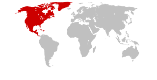
| Beskrywing | Continents with North America marked |
| Datum | (UTC) |
| Bron | Self drawn, based on Image:Continents.svg |
| Outeur | maix¿? |
| Toestemming (Hergebruik van die lêer) |
CreativeCommons ShareAlike or GPL |
| Ander weergawes | see Category:Locator maps for continents |
Lisensiëring
This file is licensed under Creative Commons ShareAlike 1.0 License.
Creative Commons has retired this legal tool and does not recommend that it be applied to works.
|

|
This work is free software; you can redistribute it and/or modify it under the terms of the GNU General Public License as published by the Free Software Foundation; either version 2 of the License, or any later version. This work is distributed in the hope that it will be useful, but without any warranty; without even the implied warranty of merchantability or fitness for a particular purpose. See version 2 and version 3 of the GNU General Public License for more details. |
Lêergeskiedenis
Klik op die datum/tyd om te sien hoe die lêer destyds gelyk het.
| Datum/Tyd | Duimnael | Dimensies | Gebruiker | Opmerking | |
|---|---|---|---|---|---|
| huidig | 21:20, 25 Januarie 2007 | | 585 × 299 (104 KG) | Maix | without CSS |
| 21:05, 25 Januarie 2007 |  | 585 × 299 (105 KG) | Maix | {{Information |Description=Continents with North America marked |Source=Self drawn, based on Image:Continents.svg |Date=~~~~~ |Author=~~~ |Permission=CreativeCommons ShareAlike or GPL |other_versions=see Category:Locator maps for continents }} |
Lêergebruik
Daar is geen bladsye wat dié lêer gebruik nie.
Globale lêergebruik
Die volgende ander wiki's gebruik hierdie lêer:
- Gebruik in als.wikipedia.org
- Kanada
- USA
- Haiti
- Mexiko
- Nordamerika
- Costa Rica
- Jamaika
- Honduras
- Belize
- Vorlage:Navigationsleiste Staaten in Nordamerika
- Barbados
- Antigua und Barbuda
- Bahamas
- St. Kitts und Nevis
- Bermuda
- Dominica
- Guatemala
- El Salvador
- Nicaragua
- Panama
- Dominikanische Republik
- Grenada
- Kuba
- St. Lucia
- St. Vincent und die Grenadinen
- Amerikanische Jungferninseln
- Anguilla
- Britische Jungferninseln
- Kaimaninseln
- Aruba
- Curaçao
- Grönland
- Guadeloupe
- Martinique
- Montserrat
- Navassa
- Puerto Rico
- Turks- und Caicosinseln
- San Andrés und Providencia
- Saint-Barthélemy (Insel)
- Saint-Martin (Insel)
- Saint-Pierre und Miquelon
- Bonaire
- Saba (Insel)
- Sint Eustatius
- Gebruik in bg.wikipedia.org
- Gebruik in de.wikipedia.org
Wys meer globale gebruik van die lêer.