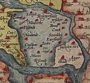
Lêer:1580 Zelandicarum v Deventer.jpg

Grootte van hierdie voorskou: 800 × 591 piksels. Ander resolusies: 320 × 237 piksels | 640 × 473 piksels | 1 024 × 757 piksels | 1 280 × 946 piksels | 2 666 × 1 971 piksels.
Oorspronklike lêer (2 666 × 1 971 piksels, lêergrootte: 1,71 MG, MIME-tipe: image/jpeg)
Lêergeskiedenis
Klik op die datum/tyd om te sien hoe die lêer destyds gelyk het.
| Datum/Tyd | Duimnael | Dimensies | Gebruiker | Opmerking | |
|---|---|---|---|---|---|
| huidig | 21:57, 2 Desember 2007 |  | 2 666 × 1 971 (1,71 MG) | Joopr | {{Information |Description=title=Zelandicarum Insularum Exactissima Et Nova Descriptio, Auctore D. Iacobo A Daventria;size=34x47cm |Source=http://www.orteliusmaps.com/stocklists/12.html |Date=1580 |Author=Ortelius naar v Deventer |Permission= |other_versi |
Lêergebruik
Die volgende bladsy gebruik dié lêer:
Globale lêergebruik
Die volgende ander wiki's gebruik hierdie lêer:
- Gebruik in arz.wikipedia.org
- Gebruik in bg.wikipedia.org
- Gebruik in crh.wikipedia.org
- Gebruik in cv.wikipedia.org
- Gebruik in de.wikipedia.org
- Gebruik in en.wikipedia.org
- Gebruik in es.wikipedia.org
- Gebruik in et.wikipedia.org
- Gebruik in fr.wikipedia.org
- Gebruik in fy.wikipedia.org
- Gebruik in he.wikipedia.org
- Gebruik in hu.wikipedia.org
- Gebruik in it.wikipedia.org
- Gebruik in ko.wikipedia.org
- Gebruik in lbe.wikipedia.org
- Gebruik in lb.wikipedia.org
- Gebruik in mk.wikipedia.org
- Gebruik in mwl.wikipedia.org
- Gebruik in nl.wikipedia.org
- Gebruik in no.wikipedia.org
- Gebruik in os.wikipedia.org
- Gebruik in pl.wikipedia.org
- Gebruik in pt.wikipedia.org
- Gebruik in ro.wikipedia.org
- Gebruik in ru.wikipedia.org
- Gebruik in ru.wikinews.org
- Gebruik in sah.wikipedia.org
- Gebruik in scn.wikipedia.org
- Gebruik in sl.wikipedia.org
Wys meer globale gebruik van die lêer.


