
Lêer:Angling in Troubled Waters A Serio-Comic Map of Europe.jpg

Grootte van hierdie voorskou: 800 × 577 piksels. Ander resolusies: 320 × 231 piksels | 640 × 462 piksels | 1 024 × 739 piksels | 1 280 × 923 piksels | 2 560 × 1 847 piksels | 7 557 × 5 452 piksels.
Oorspronklike lêer (7 557 × 5 452 piksels, lêergrootte: 9,36 MG, MIME-tipe: image/jpeg)
Opsomming
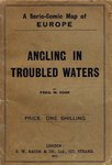
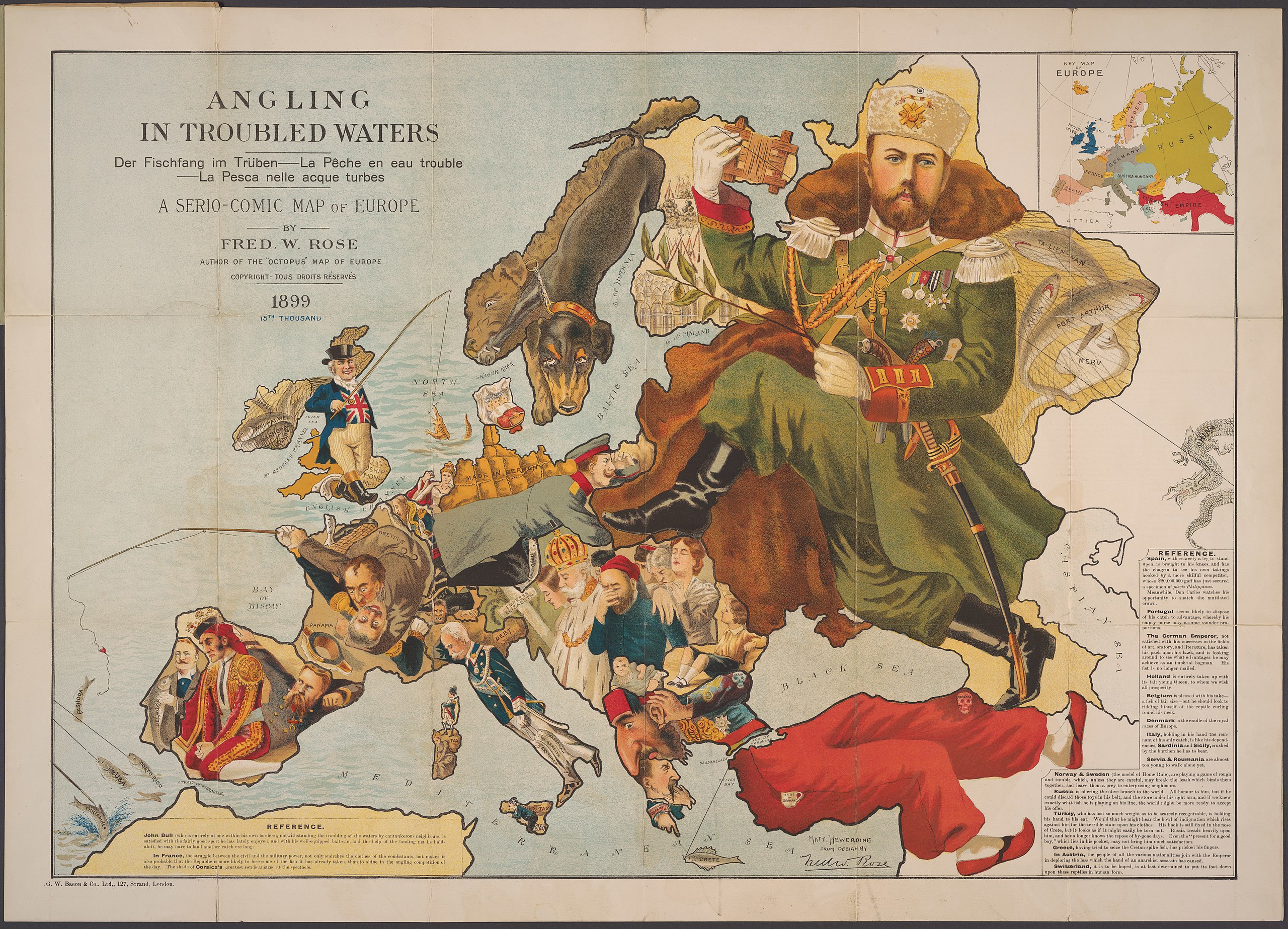
| Fred W. Rose: Satirical map of Europe in 1899
( |
|||||||||||||||||||||||||||
|---|---|---|---|---|---|---|---|---|---|---|---|---|---|---|---|---|---|---|---|---|---|---|---|---|---|---|---|
| Kunstenaar/Skepper |
|
||||||||||||||||||||||||||
| Titel |
Satirical map of Europe in 1899 |
||||||||||||||||||||||||||
| Beskrywing |
An elaborate satirical map reflecting the European situation following the Franco-Prussian war. France had suffered a crushing defeat: the loss of Alsace and much of Lorraine; Русский: Фредерик Уильям Роуз. Сатирическая карта Европы 1899г. Ловля рыбы в неспокойной воде. Карта изображает Европу после поражения Франции в войне с Пруссией с потерей Эльзаса и большой части Лотарингии. 1899г. |
||||||||||||||||||||||||||
| Dimensies | 50 x 71 | ||||||||||||||||||||||||||
| Collection |
|
||||||||||||||||||||||||||
| Plek |
Division of Rare & Manuscript Collections:Persuasive Cartography: The PJ Mode Collection |
||||||||||||||||||||||||||
| Inventarisnommer |
1135.01 |
||||||||||||||||||||||||||
| Opmerkings | See the Collector's Notes | ||||||||||||||||||||||||||
| Verwysings | For full details, see PJ. Mode, "References" | ||||||||||||||||||||||||||
| Bron/Fotograaf | Cornell University: Persuasive Cartography: The PJ Mode Collection | ||||||||||||||||||||||||||
| Ander weergawes | |||||||||||||||||||||||||||


.jpg)


Assessment
|

This image was selected as picture of the day on Vietnamese Wikipedia for 17 May 2023.
|
Lisensiëring
|
This work is in the public domain in its country of origin and other countries and areas where the copyright term is the author's life plus 70 years or fewer. This work is in the public domain in the United States because it was published (or registered with the U.S. Copyright Office) before January 1, 1929. | |
| Hierdie lêer is geïdentifiseer as vry van bekende beperkings onder kopiereg, insluitend alle verwante en naburige regte. | |
Lêergeskiedenis
Klik op die datum/tyd om te sien hoe die lêer destyds gelyk het.
| Datum/Tyd | Duimnael | Dimensies | Gebruiker | Opmerking | |
|---|---|---|---|---|---|
| huidig | 21:12, 26 Januarie 2019 | | 7 557 × 5 452 (9,36 MG) | Balkanique | User created page with UploadWizard |
Lêergebruik
Die volgende 2 bladsye gebruik dié lêer:
Globale lêergebruik
Die volgende ander wiki's gebruik hierdie lêer:
- Gebruik in cs.wikipedia.org
- Gebruik in fr.wikipedia.org
- Gebruik in ja.wikipedia.org
- Gebruik in vi.wikipedia.org