
Lêer:Athanasius Kircher's Atlantis.gif
Geen hoër resolusie is beskikbaar nie.
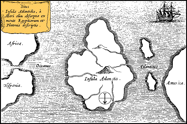
Athanasius_Kircher's_Atlantis.gif (617 × 410 piksels, lêergrootte: 36 KG, MIME-tipe: image/gif)
| Beskrywing |
Latina: Situs Insulae Atlantidis, a mari olim absorpte ex mente Aegyptiorum et Platonis descriptio.
Русский: Карта Атлантиды Афанасия Кирхера, 1669 год. Обратите внимание, север, как показано стрелкой на карте, расположен в нижней части. |
|||||||||||||||||||||||
| Datum | circa 1669 | |||||||||||||||||||||||
| Bron | https://www.haktanir.org/ | |||||||||||||||||||||||
| Outeur |
|
|||||||||||||||||||||||
| Ander weergawes |
|
|||||||||||||||||||||||


.jpg)
|
This work is in the public domain in its country of origin and other countries and areas where the copyright term is the author's life plus 100 years or fewer. | |
| Hierdie lêer is geïdentifiseer as vry van bekende beperkings onder kopiereg, insluitend alle verwante en naburige regte. | |
Lêergeskiedenis
Klik op die datum/tyd om te sien hoe die lêer destyds gelyk het.
| Datum/Tyd | Duimnael | Dimensies | Gebruiker | Opmerking | |
|---|---|---|---|---|---|
| huidig | 12:39, 15 Oktober 2013 | | 617 × 410 (36 KG) | AnonMoos | Reverted to version as of 01:05, 29 December 2005 -- rotating image turned text upside down |
| 12:37, 15 Oktober 2013 |  | 617 × 410 (36 KG) | Rotatebot | Bot: Image rotated by 180° | |
| 01:05, 29 Desember 2005 |  | 617 × 410 (36 KG) | Comae | Tomado de en.wikipedia, donde dice: Author: Athanasius_Kircher's Map of Atlantis (c.1669) Source: http://atlants.haktanir.org/ch3.html This image is in the public domain because its copyright has expired in the United States and those countries with a c |
Lêergebruik
Die volgende bladsy gebruik dié lêer:
Globale lêergebruik
Die volgende ander wiki's gebruik hierdie lêer:
- Gebruik in an.wikipedia.org
- Gebruik in ar.wikipedia.org
- Gebruik in ar.wikiversity.org
- Gebruik in ast.wikipedia.org
- Gebruik in az.wikipedia.org
- Gebruik in be-tarask.wikipedia.org
- Gebruik in beta.wikiversity.org
- Gebruik in be.wikipedia.org
- Gebruik in bg.wikipedia.org
- Gebruik in bn.wikipedia.org
- Gebruik in ca.wikipedia.org
- Gebruik in ceb.wikipedia.org
- Gebruik in cs.wikipedia.org
- Gebruik in de.wikipedia.org
- Gebruik in diq.wikipedia.org
- Gebruik in el.wikipedia.org
- Gebruik in en.wikipedia.org
- Gebruik in en.wikibooks.org
- Gebruik in en.wikiversity.org
- Gebruik in en.wikivoyage.org
- Gebruik in eo.wikipedia.org
- Gebruik in es.wikipedia.org
- Gebruik in es.wikibooks.org
- Gebruik in et.wikipedia.org
- Gebruik in eu.wikipedia.org
- Gebruik in fi.wikibooks.org
- Gebruik in fr.wiktionary.org
- Gebruik in fy.wikipedia.org
- Gebruik in gl.wikipedia.org
Wys meer globale gebruik van die lêer.