
Lêer:Barbados location map.svg

Size of this PNG preview of this SVG file: 539 × 599 piksels. Ander resolusies: 216 × 240 piksels | 432 × 480 piksels | 691 × 768 piksels | 921 × 1 024 piksels | 1 843 × 2 048 piksels | 1 205 × 1 339 piksels.
Oorspronklike lêer (SVG-lêer, normaalweg 1 205 × 1 339 piksels, lêergrootte: 125 KG)
Opsomming
| Beskrywing |
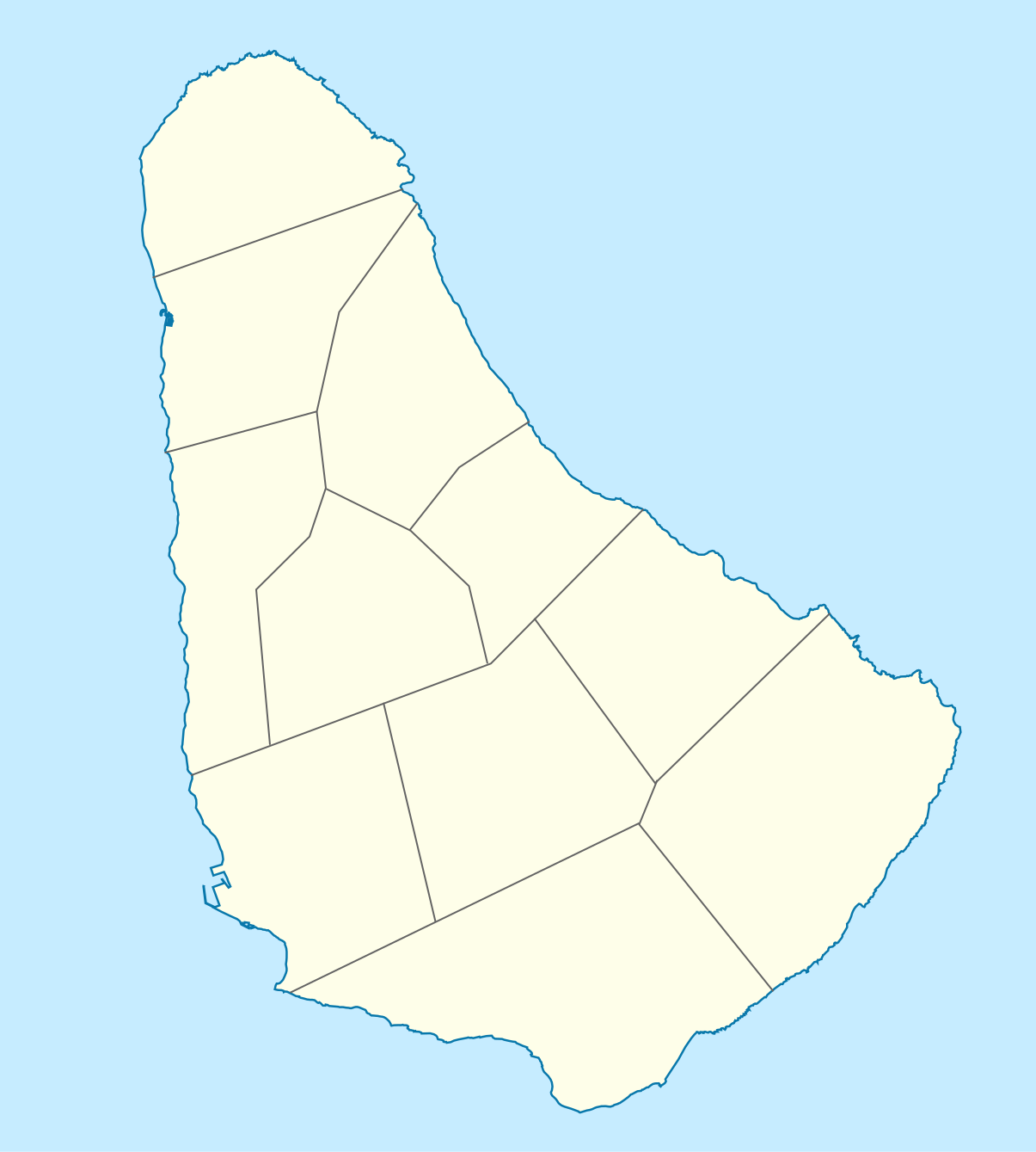
Deutsch: Positionskarte von Barbados. Geographische Begrenzungen der Karte:
English: Location map of Barbados. Geographic limits of the map:
|
| Datum | |
| Bron |
Eie werk, using
|
| Outeur |
Graphic made by Carport |
Lisensiëring
This file is licensed under the Creative Commons Attribution-Share Alike 2.0 Generic license.
- U is vry:
- om te deel – die werk kopieer, versprei en deurgee
- om te hermeng – om die werk aan te pas
- Onder die volgende voorwaardes:
- naamsvermelding – U moet die nodige krediet gee, 'n skakel na die lisensie verskaf en aandui of daar veranderinge aangebring is. U mag dit op enige redelike manier doen, maar nie op enige manier wat daarop dui dat die lisensiegewer u of u gebruik onderskryf nie.
- insgelyks – As u die materiaal hermix, transformeer of voortbou, moet u u bydraes versprei onder die dieselfde of versoenbare lisensie as die oorspronklike.
Lêergeskiedenis
Klik op die datum/tyd om te sien hoe die lêer destyds gelyk het.
| Datum/Tyd | Duimnaelskets | Dimensies | Gebruiker | Opmerking | |
|---|---|---|---|---|---|
| huidig | 14:12, 22 November 2009 | | 1 205 × 1 339 (125 KG) | Carport | {{Information |Description={{de|1=Positionskarte von {{w|Barbados|Barbados|de}}. Geographische Begrenzungen der Karte: * N: 13.349° N * S: 13,034° N * W: 59,690° W * E: 59,399° W}} {{en|1=Location map of {{w|Barbados}}. Geographic limits of the map: |
Lêergebruik
Die volgende bladsy gebruik dié lêer:
Globale lêergebruik
Die volgende ander wiki's gebruik hierdie lêer:
- Gebruik in als.wikipedia.org
- Gebruik in an.wikipedia.org
- Gebruik in ar.wikipedia.org
- Gebruik in ast.wikipedia.org
- Gebruik in az.wikipedia.org
- Gebruik in ba.wikipedia.org
- Gebruik in be.wikipedia.org
- Gebruik in bg.wikipedia.org
- Gebruik in bn.wikipedia.org
- Gebruik in bs.wikipedia.org
- Gebruik in ceb.wikipedia.org
- Plantilya:Location map Barbados
- South Point
- Saint Philip
- Saint John
- Saint George
- Pelican Island
- Pelican Islet
- Long Bay
- Crab Hill
- North Point
- Mount Misery
- Round Rock
- Green Point
- Indian River
- Bell Point
- Christchurch (pagklaro)
- Lambert Point
- Horse Hill
- Bridgetown
- Freshwater Bay
- Saint Andrews
- Greenland
- Cave Bay
- Paynes Bay
- The Salt Lakes
Wys meer globale gebruik van die lêer.