
Lêer:British bechuanaland 1887.jpg

Oorspronklike lêer (1 644 × 1 627 piksels, lêergrootte: 181 KG, MIME-tipe: image/jpeg)
Opsomming
| Beskrywing |
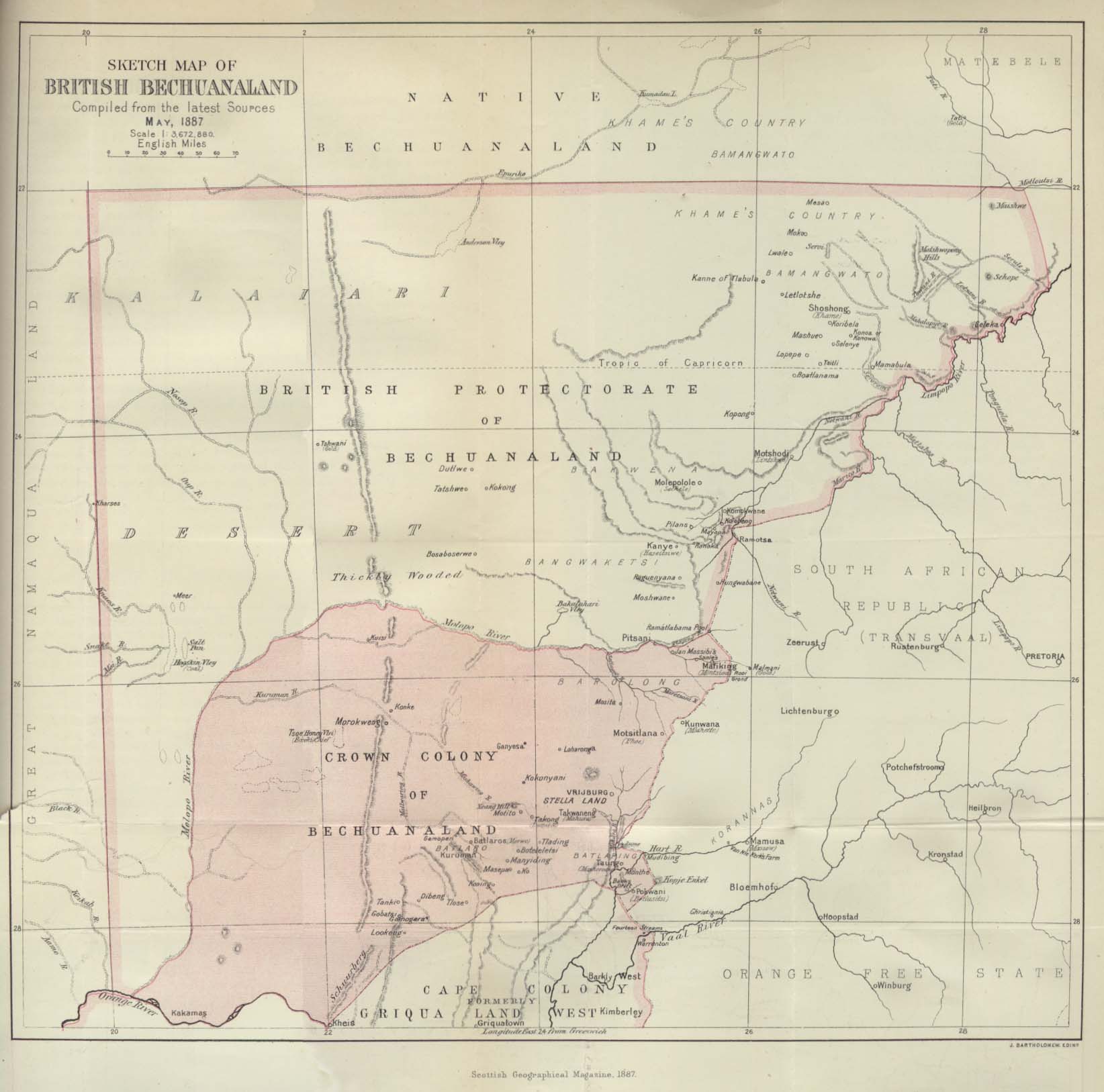
Deutsch: Karte von Betschuanaland, Mai 1887.
English: Sketch Map of British Bechuanaland, May 1887. |
| Datum | |
| Bron |
The Scottish Geographical Magazine. Published by the Scottish Geographical Society and edited by Arthur Silva White. Volume III, 1887. |
| Outeur | John George Bartholomew |
Lisensiëring
|
This work is in the public domain in its country of origin and other countries and areas where the copyright term is the author's life plus 70 years or fewer.
| |
| Hierdie lêer is geïdentifiseer as vry van bekende beperkings onder kopiereg, insluitend alle verwante en naburige regte. | |
Lêergeskiedenis
Klik op die datum/tyd om te sien hoe die lêer destyds gelyk het.
| Datum/Tyd | Duimnael | Dimensies | Gebruiker | Opmerking | |
|---|---|---|---|---|---|
| huidig | 21:09, 24 Augustus 2005 | | 1 644 × 1 627 (181 KG) | Atamari | British bechuanaland (1887) {{PD-old}} * source from http://www.lib.utexas.edu/maps/historical/british_bechuanaland_1887.jpg * "Sketch Map of British Bechuanaland, May 1887" from the Scottish Geographical Magazine. Published by the Scottish Geographical |
Lêergebruik
Die volgende 2 bladsye gebruik dié lêer:
Globale lêergebruik
Die volgende ander wiki's gebruik hierdie lêer:
- Gebruik in ast.wikipedia.org
- Gebruik in ca.wikipedia.org
- Gebruik in da.wikipedia.org
- Gebruik in de.wikipedia.org
- Gebruik in en.wikipedia.org
- Gebruik in eo.wikipedia.org
- Gebruik in es.wikipedia.org
- Gebruik in et.wikipedia.org
- Gebruik in fr.wikipedia.org
- Gebruik in id.wikipedia.org
- Gebruik in it.wikipedia.org
- Gebruik in ja.wikipedia.org
- Gebruik in no.wikipedia.org
- Gebruik in pl.wikipedia.org
- Gebruik in pt.wikipedia.org
- Gebruik in pt.wikibooks.org
- Gebruik in ru.wikipedia.org
- Gebruik in sv.wikipedia.org
- Gebruik in uk.wikipedia.org
- Gebruik in www.wikidata.org
- Gebruik in wuu.wikipedia.org
- Gebruik in zh.wikipedia.org