
Lêer:Cook new zealand.jpg
Oorspronklike lêer (861 × 1 024 piksels, lêergrootte: 307 KG, MIME-tipe: image/jpeg)
Opsomming
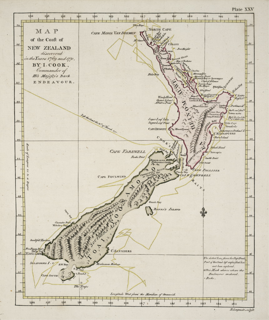
| Beskrywing | First nearly complete map of New Zealand. From the outset, the country has been in the forefront in instituting social welfare leg |
| Bron | International Cartographic Association |
| Outeur | drawn by James Cook |
| Ander weergawes | south-eastern part of the map at Image:Cook New Zealand South Cape.jpg islation. |
Lisensiëring
|
This is a faithful photographic reproduction of a two-dimensional, public domain work of art. The work of art itself is in the public domain for the following reason:
The official position taken by the Wikimedia Foundation is that "faithful reproductions of two-dimensional public domain works of art are public domain". This photographic reproduction is therefore also considered to be in the public domain in the United States. In other jurisdictions, re-use of this content may be restricted; see Reuse of PD-Art photographs for details. {{PD-Art}} template without license parameter: please specify why the underlying work is public domain in both the source country and the United States
(Usage: {{PD-Art|1=|deathyear=''year of author's death''|country=''source country''}}, where parameter #1 can be PD-old-auto, PD-old-auto-expired, PD-old-auto-1996, PD-old-100 or similar. See Commons:Multi-license copyright tags for more information.) | ||||
Lêergeskiedenis
Klik op die datum/tyd om te sien hoe die lêer destyds gelyk het.
| Datum/Tyd | Duimnael | Dimensies | Gebruiker | Opmerking | |
|---|---|---|---|---|---|
| huidig | 16:00, 21 Julie 2022 | | 861 × 1 024 (307 KG) | Serhio Magpie | Higher resolution |
| 09:18, 1 April 2007 |  | 499 × 601 (67 KG) | Ibn Battuta | sheared to reestablish proportions and orthogonal angels | |
| 23:12, 29 November 2006 |  | 500 × 603 (46 KG) | Electionworld | First nearly complete map of New Zealand, drawn by James Cook. == Licensing == {{PD-art}} Category:Old maps of New Zealand |
Lêergebruik
Die volgende bladsy gebruik dié lêer:
Globale lêergebruik
Die volgende ander wiki's gebruik hierdie lêer:
- Gebruik in ba.wikipedia.org
- Gebruik in bg.wikipedia.org
- Gebruik in ca.wikipedia.org
- Gebruik in de.wikipedia.org
- Gebruik in en.wikipedia.org
- Gebruik in en.wikibooks.org
- Gebruik in eu.wikipedia.org
- Gebruik in fi.wikipedia.org
- Gebruik in fr.wikipedia.org
- Gebruik in he.wikipedia.org
- Gebruik in hu.wikipedia.org
- Gebruik in hy.wikipedia.org
- Gebruik in ia.wikipedia.org
- Gebruik in it.wikipedia.org
- Gebruik in ko.wikipedia.org
- Gebruik in lt.wikipedia.org
- Gebruik in lv.wikipedia.org
- Gebruik in mk.wikipedia.org
- Gebruik in no.wikipedia.org
- Gebruik in os.wikipedia.org
- Gebruik in pl.wikipedia.org
- Gebruik in pt.wikipedia.org
- Gebruik in pt.wikibooks.org
- Gebruik in ru.wikipedia.org
- Gebruik in sh.wikipedia.org
- Gebruik in sv.wikipedia.org
- Gebruik in uk.wikipedia.org
- Gebruik in uz.wikipedia.org
- Gebruik in vi.wikipedia.org
- Gebruik in zh.wikipedia.org