
Lêer:Hanse-Orden.png
Oorspronklike lêer (1 263 × 753 piksels, lêergrootte: 210 KG, MIME-tipe: image/png)
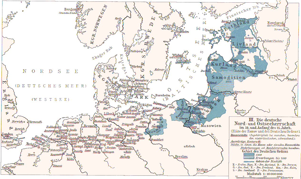
- Hanse cities underlined in red.
- Ordensstaat possessions until 1410 marked in blue colors, with year of acquisition.
- Lands of the bishoprics are marked with first letter:
- Pomesanien, Kulm (Km.), Ermland, Samland in Prussia
- Riga, Kurland, Ösel, Dorpat in the North East
- Towns of Hanseatic League are underlined in red.
Originally from 1901 edition of Putzgers Historischer Schul-Atlas and uploaded to Hanse.jpg as 100+ year old Public Domain by de:Benutzer:Olbertz. Improved quality and reduced file size by Matthead. See also at maproom.org
|
This work is in the public domain in its country of origin and other countries and areas where the copyright term is the author's life plus 70 years or fewer.
| |
| Hierdie lêer is geïdentifiseer as vry van bekende beperkings onder kopiereg, insluitend alle verwante en naburige regte. | |
Lêergeskiedenis
Klik op die datum/tyd om te sien hoe die lêer destyds gelyk het.
| Datum/Tyd | Duimnael | Dimensies | Gebruiker | Opmerking | |
|---|---|---|---|---|---|
| huidig | 23:31, 2 Desember 2007 | | 1 263 × 753 (210 KG) | Matthead | |
| 10:08, 2 Desember 2007 |  | 1 263 × 753 (219 KG) | Matthead | This map depict the extension of Hanseatic League cities and Teutonic Order lands (blue) in 14th and earl y15th century. Originally from 1901 edition of Putzgers Historischer Schul-Atlas and uploaded to [http://de.wikipedia.org/wiki/Bild:Hans |
Lêergebruik
Die volgende bladsy gebruik dié lêer:
Globale lêergebruik
Die volgende ander wiki's gebruik hierdie lêer:
- Gebruik in be-tarask.wikipedia.org
- Gebruik in de.wikipedia.org
- Gebruik in en.wikipedia.org
- Gebruik in et.wikipedia.org
- Gebruik in frr.wikipedia.org
- Gebruik in fr.wikipedia.org
- Gebruik in lt.wikibooks.org
- Gebruik in sv.wikipedia.org
- Gebruik in uk.wikipedia.org