
Lêer:ISS-38 Prince Albert, South Africa, Sand and Gamka Rivers.jpg
Grootte van hierdie voorskou: 747 × 600 piksels. Ander resolusies: 299 × 240 piksels | 598 × 480 piksels | 957 × 768 piksels | 1 276 × 1 024 piksels | 2 551 × 2 048 piksels | 2 560 × 2 055 piksels.
Oorspronklike lêer (2 560 × 2 055 piksels, lêergrootte: 939 KG, MIME-tipe: image/jpeg)
Opsomming
| Beskrywing |
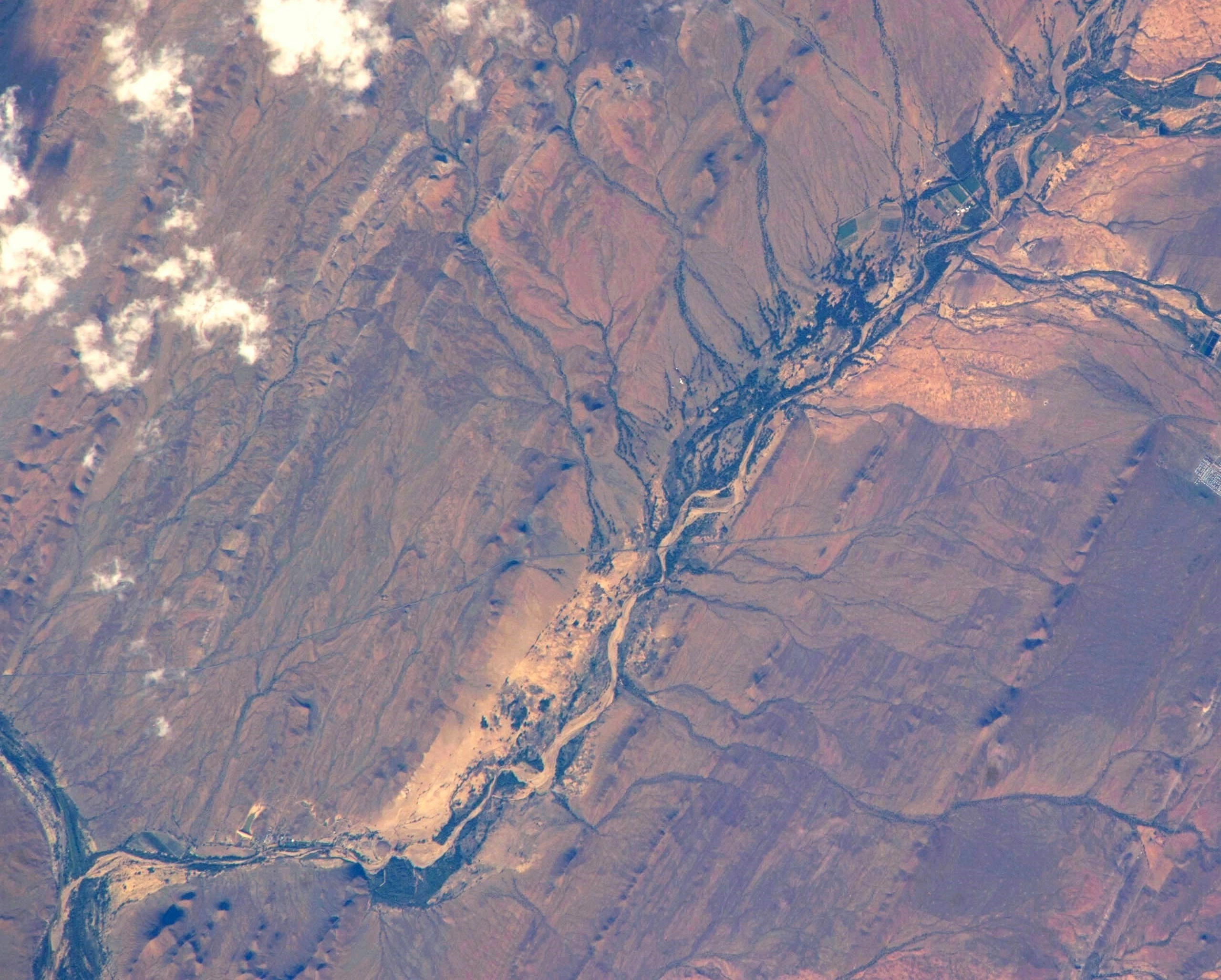
Afrikaans: Die droë loop van die Sandrivier, diagonaal op beeld, sluit hier aan by die Gamka (onder links) naby Prins Albert in die Koup, Suid-Afrika.
English: The dry course of the Sand River, forming a diagonal on the photo, has its confluence with the Gamka River at bottom left, in the vicinity of Prince Albert in the Great Karoo, South Africa. |
| Datum | |
| Bron | https://www.flickr.com/photos/nasa2explore/12617286703/ |
| Outeur | NASA |
| Ander weergawes |
 |
| Objekligging | | Hierdie en ander beelde in: OpenStreetMap |
|---|
This image or video was catalogued by Johnson Space Center of the United States National Aeronautics and Space Administration (NASA) under Photo ID: ISS038-E-039032. This tag does not indicate the copyright status of the attached work. A normal copyright tag is still required. See Commons:Licensing. Other languages:
|
Lisensiëring
This file is in the public domain in the United States because it was created by the Image Science & Analysis Laboratory, of the NASA Johnson Space Center. NASA copyright policy states that "NASA material is not protected by copyright unless noted". (NASA media use guidelines or Conditions of Use of Astronaut Photographs).
Photo source: ISS038-E-039032.
|
Lêergeskiedenis
Klik op die datum/tyd om te sien hoe die lêer destyds gelyk het.
| Datum/Tyd | Duimnael | Dimensies | Gebruiker | Opmerking | |
|---|---|---|---|---|---|
| huidig | 22:34, 9 Julie 2020 | | 2 560 × 2 055 (939 KG) | JMK | {{Information |description ={{en|1=Sand River, with its confluence with the Gamka River at bottom left, in the Great Karoo, South Africa}} |date =2014-01-30 |source =https://www.flickr.com/photos/nasa2explore/12617286703/ |author =NASA }} Category:Gamka River |
Lêergebruik
Die volgende bladsy gebruik dié lêer: