
Lêer:LocationGriqualandEast.svg

Size of this PNG preview of this SVG file: 800 × 400 piksels. Ander resolusies: 320 × 160 piksels | 640 × 320 piksels | 1 024 × 512 piksels | 1 280 × 640 piksels | 2 560 × 1 280 piksels | 1 000 × 500 piksels.
Oorspronklike lêer (SVG-lêer, normaalweg 1 000 × 500 piksels, lêergrootte: 2,72 MG)
Opsomming
| Beskrywing |
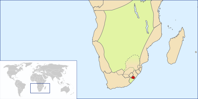
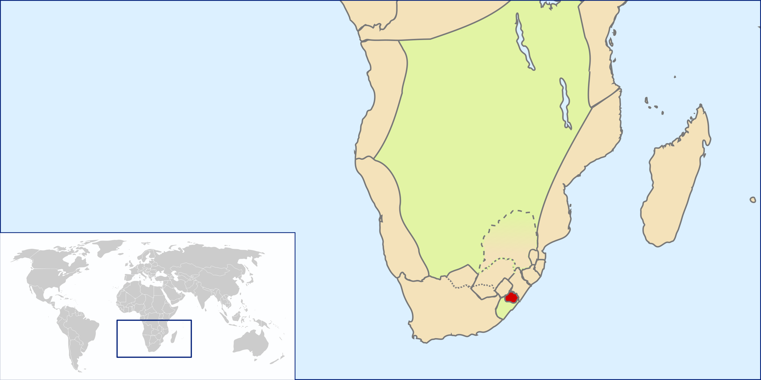
English: Location of Griqualand East, Southern Africa, ~1861(?)-1874 before annexation into Cape Colony |
| Datum | |
| Bron | Own work by uploader based on File:LocationSouthAfrica.svg |
| Outeur | Seb az86556 |
Lisensiëring
Ek, die outeursreghouer van hierdie werk, publiseer dit onder die volgende lisensie:
This file is licensed under the Creative Commons Attribution 3.0 Unported license.
- U is vry:
- om te deel – die werk kopieer, versprei en deurgee
- om te hermeng – om die werk aan te pas
- Onder die volgende voorwaardes:
- naamsvermelding – U moet die nodige krediet gee, 'n skakel na die lisensie verskaf en aandui of daar veranderinge aangebring is. U mag dit op enige redelike manier doen, maar nie op enige manier wat daarop dui dat die lisensiegewer u of u gebruik onderskryf nie.
Lêergeskiedenis
Klik op die datum/tyd om te sien hoe die lêer destyds gelyk het.
| Datum/Tyd | Duimnaelskets | Dimensies | Gebruiker | Opmerking | |
|---|---|---|---|---|---|
| huidig | 09:00, 1 Augustus 2009 | | 1 000 × 500 (2,72 MG) | Seb az86556 | adjusted borders |
| 17:43, 31 Julie 2009 |  | 1 000 × 500 (2,71 MG) | Seb az86556 | {{Information |Description={{en|1=Location of Griqualand East, Southern Africa, ~1861(?)-1874 before annexation into Cape Colony}} |Source=Own work by uploader based on File:LocationSouthAfrica.svg |Author=Seb az86556 |Date=2009- |
Lêergebruik
Die volgende bladsy gebruik dié lêer:
Globale lêergebruik
Die volgende ander wiki's gebruik hierdie lêer:
- Gebruik in ca.wikipedia.org
- Gebruik in es.wikipedia.org
- Gebruik in fr.wikipedia.org
- Gebruik in he.wikipedia.org
- Gebruik in nl.wikipedia.org
- Gebruik in ru.wikipedia.org
- Gebruik in sv.wikipedia.org
- Gebruik in uk.wikipedia.org
- Gebruik in www.wikidata.org