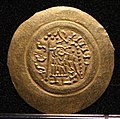
Lêer:Tremisse di aistulf con monogramma, ticinum-pavia 749-756.jpg

Oorspronklike lêer (904 × 896 piksels, lêergrootte: 638 KG, MIME-tipe: image/jpeg)
Hierdie lêer kom vanaf Wikimedia Commons en kan ook in ander projekte gebruik word. Die beskrywing op die lêer se inligtingsblad word hieronder weergegee.
Opsomming
| BeskrywingTremisse di aistulf con monogramma, ticinum-pavia 749-756.jpg |
Italiano: Museo Archeologico Nazionale di Cividale
|
|||||
| Datum | ||||||
| Bron | Eie werk | |||||
| Outeur | Sailko |
| Kameraligging | 46° 05′ 36,56″ N, 13° 25′ 55,63″ E | Hierdie en ander beelde in: OpenStreetMap |
|---|
Lisensiëring
- U is vry:
- om te deel – die werk kopieer, versprei en deurgee
- om te hermeng – om die werk aan te pas
- Onder die volgende voorwaardes:
- naamsvermelding – U moet die nodige krediet gee, 'n skakel na die lisensie verskaf en aandui of daar veranderinge aangebring is. U mag dit op enige redelike manier doen, maar nie op enige manier wat daarop dui dat die lisensiegewer u of u gebruik onderskryf nie.
- insgelyks – As u die materiaal hermix, transformeer of voortbou, moet u u bydraes versprei onder die dieselfde of versoenbare lisensie as die oorspronklike.

|
Hierdie beeld is opgelaai as deel van Wiki Lief Monumente 2016.
Afrikaans ∙ Alemannisch ∙ azərbaycanca ∙ Bahasa Indonesia ∙ Bahasa Melayu ∙ Bikol Central ∙ bosanski ∙ brezhoneg ∙ català ∙ čeština ∙ Cymraeg ∙ dansk ∙ davvisámegiella ∙ Deutsch ∙ eesti ∙ English ∙ español ∙ Esperanto ∙ euskara ∙ français ∙ Frysk ∙ Gaeilge ∙ galego ∙ hrvatski ∙ Ido ∙ italiano ∙ latviešu ∙ Lëtzebuergesch ∙ Malagasy ∙ magyar ∙ Malti ∙ Nederlands ∙ norsk ∙ norsk nynorsk ∙ norsk bokmål ∙ polski ∙ português ∙ português do Brasil ∙ română ∙ shqip ∙ sicilianu ∙ slovenčina ∙ slovenščina ∙ suomi ∙ svenska ∙ Tagalog ∙ Türkçe ∙ Yorùbá ∙ Zazaki ∙ Ελληνικά ∙ беларуская ∙ беларуская (тарашкевіца) ∙ български ∙ кыргызча ∙ македонски ∙ русский ∙ српски / srpski ∙ українська ∙ ქართული ∙ հայերեն ∙ नेपाली ∙ हिन्दी ∙ বাংলা ∙ മലയാളം ∙ ไทย ∙ 한국어 ∙ +/− |

|
The making of this document was supported by Wikimedia CH. (Submit your project!) For all the files concerned, please see the category Supported by Wikimedia CH. العربية ∙ বাংলা ∙ čeština ∙ Deutsch ∙ English ∙ Esperanto ∙ español ∙ français ∙ galego ∙ magyar ∙ italiano ∙ 日本語 ∙ македонски ∙ Nederlands ∙ português do Brasil ∙ rumantsch ∙ русский ∙ sicilianu ∙ slovenščina ∙ українська ∙ +/−
|
Captions
Items portrayed in this file
uitbeelding
some value
copyrighted Engels
source of file Engels
9 April 2016
46°5'36.56"N, 13°25'55.63"E
captured with Engels
Wikimedia CH Engels
exposure time Engels
0,004 sekonde
f-number Engels
5,6
focal length Engels
135 millimeter
ISO speed Engels
4 000
media type Engels
image/jpeg
Lêergeskiedenis
Klik op die datum/tyd om te sien hoe die lêer destyds gelyk het.
| Datum/Tyd | Duimnael | Dimensies | Gebruiker | Opmerking | |
|---|---|---|---|---|---|
| huidig | 12:51, 16 September 2016 |  | 904 × 896 (638 KG) | Sailko | User created page with UploadWizard |
Lêergebruik
Die volgende bladsy gebruik dié lêer:
Metadata
Die lêer bevat aanvullende inligting wat moontlik deur 'n digitale kamera of skandeerder bygevoeg is.
As die lêer verander is, sal sekere inligting dalk nie meer ooreenkom met dié van die gewysigde lêer nie.
| Kameravervaardiger: | Canon |
|---|---|
| Kameramodel | Canon EOS 700D |
| Beligtingstyd | 1/250 sek (0,004) |
| F-getal | f/5,6 |
| ISO/ASA-waarde | 4 000 |
| Gegewens opgestel op | 15:17, 9 April 2016 |
| Brandpuntsafstand | 135 mm |
| Oriëntasie | Normaal |
| Horisontale resolusie | 72 dpi |
| Vertikale resolusie | 72 dpi |
| Sagteware gebruik | Adobe Photoshop CS4 Windows |
| Tydstip laaste lêerwysiging | 19:34, 4 September 2016 |
| Y- en C-posisionering | Val saam |
| Beligtingsprogram | Diafragma-prioriteit |
| Exif-weergawe | 2.3 |
| Datum en tyd van digitalisering | 15:17, 9 April 2016 |
| Betekenis van elke komponent |
|
| Sluitersnelheid in APEX | 8 |
| Diafragma in APEX | 5 |
| Beligtingskompensasie | −1 |
| Metode van ligmeting | Patroon |
| Flits | Flits het nie afgegaan, flitser verplig onderdruk |
| Datum tyd subsekondes | 60 |
| Subsekondes tydstip datagenerasie | 60 |
| Subsekondes tydstip digitalisasie | 60 |
| Ondersteunde Flashpix-weergawe | 1 |
| Kleurruimte | sRGB |
| Brandpuntsvlak-X-resolusie | 3 865,7718120805 |
| Brandpuntsvlak-Y-resolusie | 3 859,2964824121 |
| Eenheid CCD-resolusie | duim |
| Aangepaste beeldverwerking | Normale verwerking |
| Beligtingsinstelling | Outomatiese beligting |
| Witbalans | Outomatiese witbalans |
| Soort opname | Standaard |
| GPS-merkerweergawe | 0.0.3.2 |
| Ondersteunde Flashpix-weergawe | 1 |
| Beeldwydte | 904 px |
| Beeldhoogte | 896 px |
| Waardering (uit 5) | 0 |
| Datum waarop metadata laas verander is | 21:34, 4 September 2016 |
| Unieke ID van die oorspronklike dokument | xmp.did:604239C8C572E611A9E4A04CF609E8C8 |
| IIM-weergawe | 111 |


