
Lêer:Upwelling image1.jpg
Geen hoër resolusie is beskikbaar nie.
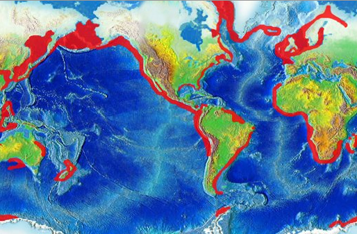
Upwelling_image1.jpg (514 × 337 piksels, lêergrootte: 187 KG, MIME-tipe: image/jpeg)
Opsomming
| Beskrywing |
English: Global map highlighting areas of upwelling |
| Datum |
13 September 2008 (original upload date) |
| Bron | http://oceanservice.noaa.gov/education/kits/currents/media/upwelling_image1.jpg |
| Outeur | NOAA |
| Toestemming (Hergebruik van die lêer) |
US Federal Government |
Lisensiëring
This image is in the public domain because it contains materials that originally came from the U.S. National Oceanic and Atmospheric Administration, taken or made as part of an employee's official duties.
|
Oorspronklike oplaailogboek
Transferred from en.wikipedia to Commons by Wcam using CommonsHelper.
The original description page was here. All following user names refer to en.wikipedia.
- 2008-09-13 17:59 Mikiemike 514×337× (191795 bytes) {{Information |Description=Global map highlighting areas of upwelling |Source=http://oceanservice.noaa.gov/education/kits/currents/media/upwelling_image1.jpg |Date=9-13-08 |Author=NOAA |Permission=US Federal Government |other_versions= }}
Lêergeskiedenis
Klik op die datum/tyd om te sien hoe die lêer destyds gelyk het.
| Datum/Tyd | Duimnael | Dimensies | Gebruiker | Opmerking | |
|---|---|---|---|---|---|
| huidig | 01:30, 15 Januarie 2009 | | 514 × 337 (187 KG) | File Upload Bot (Magnus Manske) | {{BotMoveToCommons|en.wikipedia}} {{Information |Description={{en|Global map highlighting areas of upwelling}} |Source=Transferred from [http://en.wikipedia.org en.wikipedia]; transferred to Commons by User:Wcam using [http://tools.wikimedia.de/~magn |
Lêergebruik
Die volgende bladsy gebruik dié lêer:
Globale lêergebruik
Die volgende ander wiki's gebruik hierdie lêer:
- Gebruik in ar.wikipedia.org
- Gebruik in ast.wikipedia.org
- Gebruik in bn.wikipedia.org
- Gebruik in bs.wikipedia.org
- Gebruik in ca.wikipedia.org
- Gebruik in da.wikipedia.org
- Gebruik in de.wikipedia.org
- Gebruik in en.wikipedia.org
- Gebruik in eo.wikipedia.org
- Gebruik in es.wikipedia.org
- Gebruik in eu.wikipedia.org
- Gebruik in fa.wikipedia.org
- Gebruik in fr.wikipedia.org
- Gebruik in it.wikipedia.org
- Gebruik in ka.wikipedia.org
- Gebruik in kk.wikipedia.org
- Gebruik in ko.wikipedia.org
- Gebruik in lv.wikipedia.org
- Gebruik in ml.wikipedia.org
- Gebruik in ms.wikipedia.org
- Gebruik in nl.wikipedia.org
- Gebruik in nn.wikipedia.org
- Gebruik in no.wikipedia.org
- Gebruik in pl.wikipedia.org
- Gebruik in pt.wikipedia.org
- Gebruik in ru.wikipedia.org
- Gebruik in sl.wikipedia.org
- Gebruik in th.wikipedia.org
- Gebruik in tr.wikipedia.org
- Gebruik in ur.wikipedia.org
- Gebruik in vi.wikipedia.org
- Gebruik in zh.wikipedia.org
Wys meer globale gebruik van die lêer.