
Lêer:South Africa Free State location map.svg

Size of this PNG preview of this SVG file: 672 × 599 piksels. Ander resolusies: 269 × 240 piksels | 538 × 480 piksels | 861 × 768 piksels | 1 148 × 1 024 piksels | 2 296 × 2 048 piksels | 1 130 × 1 008 piksels.
Oorspronklike lêer (SVG-lêer, normaalweg 1 130 × 1 008 piksels, lêergrootte: 286 KG)
Opsomming
| Beskrywing |
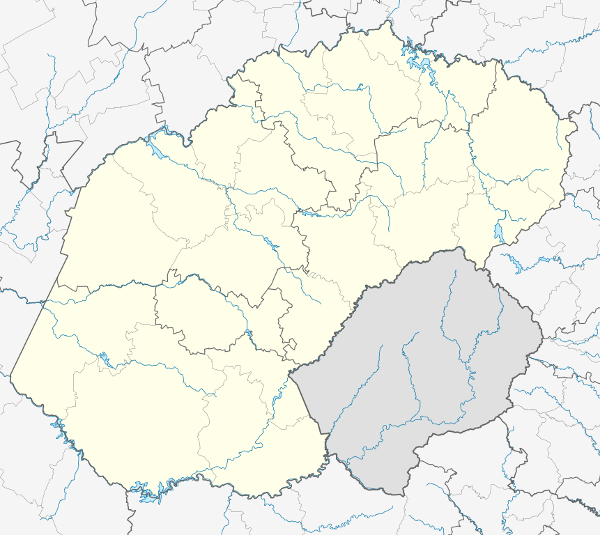
English: Location map of the Free State
Equirectangular projection, N/S stretching 114%. Geographic limits of the map:
|
| Datum | |
| Bron |
|
| Outeur | Htonl |
| Toestemming (Hergebruik van die lêer) |
Ek, die outeursreghouer van hierdie werk, publiseer dit onder die volgende lisensie: Hierdie lêer is gelisensieer onder die Creative Commons Erkenning-Insgelyks Deel 3.0 Onoorgedraagde lisensie.
|
| Ander weergawes | File:South Africa Free State relief location map.svg, File:Blank map of the Free State (2011).svg |
.svg)
Lêergeskiedenis
Klik op die datum/tyd om te sien hoe die lêer destyds gelyk het.
| Datum/Tyd | Duimnael | Dimensies | Gebruiker | Opmerking | |
|---|---|---|---|---|---|
| huidig | 23:54, 5 Januarie 2013 | | 1 130 × 1 008 (286 KG) | Htonl | == {{int:filedesc}} == {{Information |Description ={{en|Location map of the en:Free State Equirectangular projection, N/S stretching 114%. Geographic limits of the map: * N: 26.5° S * S: 31° S * W: 24.25° E * E: 30° E}} |Source = *... |
Lêergebruik
Meer as 100 bladsye gebruik dié lêer. Die volgende lys vertoon die eerste 100 bladsye wat slegs dié lêer gebruik. 'n Volledige lys is beskikbaar.
- Allanridge
- Arlington, Vrystaat
- Bethlehem, Vrystaat
- Bethulie
- Bloemfontein
- Boshof
- Bothaville
- Botshabelo
- Brandfort
- Bultfontein
- Clarens, Vrystaat
- Clocolan
- Cornelia
- Dealesville
- Deneysville
- Dewetsdorp
- Edenburg
- Edenville
- Excelsior, Vrystaat
- Fauresmith
- Ficksburg
- Fouriesburg
- Frankfort
- Gariepdam (dorp)
- Golden Gate-Hoogland- Nasionale Park
- Harrismith
- Heilbron
- Hennenman
- Hertzogville
- Hobhouse
- Hoopstad
- Jacobsdal
- Jagersfontein
- Kestell
- Koffiefontein
- Koppies
- Kroonstad
- Ladybrand
- Lindley
- Luckhoff
- Marquard
- Maselspoort
- Matlakeng
- Memel, Vrystaat
- Mofulatshepe
- Odendaalsrus
- Oranjeville
- Parys, Vrystaat
- Paul Roux
- Petrus Steyn
- Petrusburg
- Philippolis
- Phuthaditjhaba
- Ratanang
- Reddersburg
- Reitz
- Riebeeckstad
- Rosendal
- Rouxville
- Sandrivier
- Sannaspos
- Sasolburg
- Saundershoogte
- Senekal
- Smithfield
- Soutpan
- Springfontein
- Steynsrus
- Swinburne
- Teisesville
- Thaba Nchu
- Thembalihle
- Theunissen
- Trompsburg
- Tweeling, Vrystaat
- Tweespruit
- Uitkoms
- Valsrivier (Vaal)
- Van Stadensrus
- Ventersburg
- Verkeerdevlei
- Verkykerskop
- Vetrivier
- Vierfontein
- Viljoensdrif
- Viljoenskroon
- Villiers
- Virginia
- Vrede, Vrystaat
- Vredefort
- Warden
- Welkom
- Wepener
- Wesselsbron
- Westminster
- Whites
- Winburg
- Zamani
- Zastron
- Zenzeleni
Wys meer skakels na die lêer.
Globale lêergebruik
Die volgende ander wiki's gebruik hierdie lêer:
- Gebruik in ar.wikipedia.org
- Gebruik in azb.wikipedia.org
- Gebruik in bg.wikipedia.org
- Gebruik in ceb.wikipedia.org
- Plantilya:Location map South Africa Free State
- Rietspruit
- Doringspruit
- Brakspruit
- Harrismith
- Groenkop (bukid sa Habagatang Aprika, Free State)
- Pampoenspruit (suba sa Habagatang Aprika, Free State)
- Houthoekspruit
- Gansvleispruit
- Brakspruit (suba sa Habagatang Aprika, Free State, lat -28,05, long 28,09)
- Gebruik in de.wikipedia.org
- Gebruik in en.wikipedia.org
- Bloemfontein
- Bram Fischer International Airport
- Virginia, South Africa
- Bultfontein
- Air Force Base Bloemspruit
- Kroonstad
- Welkom
- Arlington, South Africa
- Bethlehem, South Africa
- Clarens, South Africa
- Clocolan
- Cornelia, South Africa
- Excelsior, South Africa
- Ficksburg
- Fouriesburg
- Harrismith
- Swinburne, Free State
- Hobhouse, South Africa
- Kestell
- Ladybrand
- Lindley, Free State
- Marquard
- Memel, South Africa
- Paul Roux
- Petrus Steyn
- Reitz, Free State
- Rosendal, South Africa
- Senekal
- Steynsrus
Wys meer globale gebruik van die lêer.