Asmara: Verskil tussen weergawes
Content deleted Content added
Bygewerk |
k + skakels |
||
| Lyn 60: | Lyn 60: | ||
|} |
|} |
||
'''Asmara''' ([[Arabies]]: أسمرة, [[ |
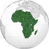
'''Asmara''' ([[Arabies]]: أسمرة, [[Tigrinya]]: ኣስመራ, voorheen ''Asmera'') is die [[hoofstad]] en grootste stad van [[Eritrea]] met 'n bevolking van 804 000 in 2017 en 'n oppervlakte van 45 km².<ref>{{en}} {{cite web |url=https://www.cia.gov/library/publications/the-world-factbook/geos/er.html |title=Eritrea |work=The World Factbook |author=[[Central Intelligence Agency]] |date=15 Junie 2017 |accessdate=8 Julie 2017}}</ref> Die stad is in die sentrum van Eritrea in die [[Groot Skeurvallei]] geleë. Asmara is bekend vir sy goed bewaarde koloniale [[Italië|Italiaanse]] [[Modernisme|Mondernistiese]] argitektuur.<ref>{{en}} Mark Byrnes [http://www.theatlanticcities.com/neighborhoods/2012/02/african-citys-unusual-preservation-legacy/1163/ An African City's Unusual Preservation Legacy], 8 Februarie 2012, Atlantic Cities</ref> Die Mondernistiese stad van Asmara is in 2017 deur [[Unesco]] as [[wêrelderfenisgebied]] gelys. |
||
== Verwysings == |
== Verwysings == |
||
| Lyn 67: | Lyn 67: | ||
== Eksterne skakels == |
== Eksterne skakels == |
||
{{CommonsKategorie-inlyn}} |
{{CommonsKategorie-inlyn}} |
||
* {{en}} {{Wikivoyage|Asmara}} |
|||
* {{en}} {{fr}} [http://whc.unesco.org/sites/1550.htm Amptelike Unesco-bladsy] |
* {{en}} {{fr}} [http://whc.unesco.org/sites/1550.htm Amptelike Unesco-bladsy] |
||
Wysiging soos op 20:30, 27 Januarie 2018
| Kaart | Wapen |
 | |
| Vlag | |
 | |
| Land | |
| Streek | Maekel |
| Koördinate | 15°19′N 38°55′O / 15.317°N 38.917°O |
| Stigting | 12de eeu |
| Oppervlakte: | |
| - Totaal | 45 vk km |
| Hoogte bo seevlak | 2 325 m |
| Bevolking: | |
| - Totaal (2017) | 804 000 |
| - Bevolkingsdigtheid | 53,38/vk km |
| Tydsone | UTC +3 |
| Burgemeester | Semere Russom |
Asmara (Arabies: أسمرة, Tigrinya: ኣስመራ, voorheen Asmera) is die hoofstad en grootste stad van Eritrea met 'n bevolking van 804 000 in 2017 en 'n oppervlakte van 45 km².[1] Die stad is in die sentrum van Eritrea in die Groot Skeurvallei geleë. Asmara is bekend vir sy goed bewaarde koloniale Italiaanse Mondernistiese argitektuur.[2] Die Mondernistiese stad van Asmara is in 2017 deur Unesco as wêrelderfenisgebied gelys.
Verwysings
- ↑ (en) Central Intelligence Agency (15 Junie 2017). "Eritrea". The World Factbook. Besoek op 8 Julie 2017.
- ↑ (en) Mark Byrnes An African City's Unusual Preservation Legacy, 8 Februarie 2012, Atlantic Cities
Eksterne skakels
 Wikimedia Commons het meer media in die kategorie Asmara.
- (en) Toerisme-inligting oor Asmara op Wikivoyage
- (en) (fr) Amptelike Unesco-bladsy


