
Lêer:Lesotho location map.svg

Size of this PNG preview of this SVG file: 613 × 599 piksels. Ander resolusies: 246 × 240 piksels | 491 × 480 piksels | 786 × 768 piksels | 1 048 × 1 024 piksels | 2 095 × 2 048 piksels | 1 023 × 1 000 piksels.
Oorspronklike lêer (SVG-lêer, normaalweg 1 023 × 1 000 piksels, lêergrootte: 104 KG)
| Beskrywing |
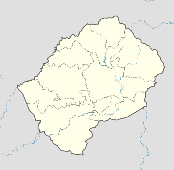
Deutsch: Positionskarte von Lesotho Quadratische Plattkarte.
English: Location map of Lesotho Equirectangular projection.
Geographic limits of the map:
|
| Datum | (UTC) |
| Bron | |
| Outeur |
|
| Ander weergawes |
Derivative work: |

|
Toestemming word verleen tot die kopiëring, verspreiding en/of wysiging van hierdie dokument onder die voorwaardes van die GNU-lisensie vir vrye dokumentasie, weergawe 1.2 of enige latere weergawe uitgegee deur die Stigting vir Vrye Sagteware, sonder Invariante Dele, geen Voorbladtekste en geen Agterbladtekste. 'n Kopie van hierdie lisensie is ingesluit in die afdeling getiteld GNU Free Documentation License. |
Hierdie lêer is gelisensieer onder die Creative Commons Erkenning-Insgelyks Deel 3.0 Onoorgedraagde lisensie.
- U is vry:
- om te deel – die werk kopieer, versprei en deurgee
- om te hermeng – om die werk aan te pas
- Onder die volgende voorwaardes:
- naamsvermelding – U moet die nodige krediet gee, 'n skakel na die lisensie verskaf en aandui of daar veranderinge aangebring is. U mag dit op enige redelike manier doen, maar nie op enige manier wat daarop dui dat die lisensiegewer u of u gebruik onderskryf nie.
- insgelyks – As u die materiaal hermix, transformeer of voortbou, moet u u bydraes versprei onder die dieselfde of versoenbare lisensie as die oorspronklike.
Oorspronklike oplaailogboek
This image is a derivative work of the following images:
- File:South_Africa_location_map.svg licensed with Cc-by-3.0, Cc-by-3.0/de, GFDL, GFDL/de
- 2009-02-25T20:39:30Z NordNordWest 2032x1742 (670054 Bytes) {{Information |Description= {{de|Positionskarte von [[:de:Südafrika|Südafrika]]}} Quadratische Plattkarte, N-S-Streckung 110 %. Geographische Begrenzung der Karte: * N: 21.8° S * S: 35.2° S * W: 16.0° O * O: 33.2° O {{e
- File:Lesotho_Locator.png licensed with Cc-by-sa-3.0,2.5,2.0,1.0, GFDL
- 2008-03-06T18:16:28Z Sadalmelik 1403x1381 (47930 Bytes) {{Information |Description=Location map for Lesotho. Left:26.8, bottom:-31, right:29.75, top-28.1 |Source=self-made |Date= |Author= [[User:Sadalmelik|Sadalmelik]] |Permission= |other_versions= }} [[Category:Maps of Lesotho]]
Uploaded with derivativeFX
Lêergeskiedenis
Klik op die datum/tyd om te sien hoe die lêer destyds gelyk het.
| Datum/Tyd | Duimnael | Dimensies | Gebruiker | Opmerking | |
|---|---|---|---|---|---|
| huidig | 18:04, 21 Oktober 2013 | | 1 023 × 1 000 (104 KG) | NordNordWest | corr, see file description |
| 07:02, 7 Maart 2010 |  | 1 023 × 1 000 (146 KG) | Spischot | Default size inceased | |
| 20:31, 28 Oktober 2009 |  | 340 × 332 (193 KG) | Spischot | {{Information |Description={{de|Positionskarte von Lesotho}} Quadratische Plattkarte. {{en|Location map of Lesotho}} Equirectangular projection. Geographic limits of the map: * N: 28.33° S * S: 30.89° S * W: 26.74° |
Lêergebruik
Daar is geen bladsye wat dié lêer gebruik nie.
Globale lêergebruik
Die volgende ander wiki's gebruik hierdie lêer:
- Gebruik in ar.wikipedia.org
- Gebruik in bg.wikipedia.org
- Gebruik in bn.wikipedia.org
- Gebruik in bs.wikipedia.org
- Gebruik in ce.wikipedia.org
- Gebruik in cs.wikipedia.org
- Gebruik in de.wikipedia.org
- Gebruik in el.wikipedia.org
- Gebruik in en.wikipedia.org
- Gebruik in eo.wikipedia.org
- Gebruik in es.wikipedia.org
- Gebruik in et.wikipedia.org
- Gebruik in fa.wikipedia.org
- Gebruik in fi.wikipedia.org
- Gebruik in he.wikivoyage.org
- Gebruik in kaa.wikipedia.org
- Gebruik in ka.wikipedia.org
- Gebruik in kn.wikipedia.org
- Gebruik in ko.wikipedia.org
- Gebruik in lt.wikipedia.org
- Gebruik in lv.wikipedia.org
Wys meer globale gebruik van die lêer.