
Lêer:Official LanguagesMap-Africa.png
Geen hoër resolusie is beskikbaar nie.
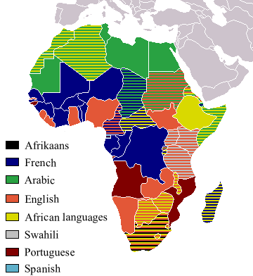
Official_LanguagesMap-Africa.png (360 × 392 piksels, lêergrootte: 21 KG, MIME-tipe: image/png)

|
File:Official LanguagesMap-Africa.svg is a vector version of this file. It should be used in place of this PNG file when not inferior.
File:Official LanguagesMap-Africa.png → File:Official LanguagesMap-Africa.svg
For more information, see Help:SVG. |
 |
Taken from Image:BlankMap-Africa.png. Information from http://www.nationsonline.org/oneworld/index.html and CIA World Factbook
| Ek, die outeursreghouer van hierdie werk, stel dit hiermee in die publieke domein vry. Dit geld wêreldwyd. In sommige lande is dit dalk nie wettiglik moontlik nie. Indien so: Ek verleen aan enigiemand die reg om hierdie werk te gebruik vir enige doel, sonder voorwaardes, tensy sulke voorwaardes deur die wet vereis word. |
Other version
-
 Afrikaans
 -
 Français


Lêergeskiedenis
Klik op die datum/tyd om te sien hoe die lêer destyds gelyk het.
| Datum/Tyd | Duimnael | Dimensies | Gebruiker | Opmerking | |
|---|---|---|---|---|---|
| huidig | 18:05, 16 Maart 2018 | | 360 × 392 (21 KG) | Maphobbyist | Updates |
| 12:54, 6 Mei 2008 |  | 746 × 813 (250 KG) | Ant75 | Updated Madagascar to English, French and Traditional African following 2007 Constitution. | |
| 12:54, 1 Mei 2008 |  | 720 × 784 (186 KG) | Ant75 | Updated Sudan to English and Arabic following 2005 Constitution. | |
| 19:59, 16 Maart 2007 |  | 360 × 392 (14 KG) | Rasulo~commonswiki | Updated earlier version due to officialization of Swahili in Uganda. Also corrected the language status of Zimbabwe where Shona and Ndebele are currently co-official with English. | |
| 17:05, 19 Mei 2005 |  | 360 × 392 (14 KG) | Rydia~commonswiki | Taken from Image:BlankMap-Africa.png. Information from http://www.nationsonline.org/oneworld/index.html and CIA World Factbook {{PD}} |
Lêergebruik
Daar is geen bladsye wat dié lêer gebruik nie.
Globale lêergebruik
Die volgende ander wiki's gebruik hierdie lêer:
- Gebruik in ca.wikipedia.org
- Gebruik in de.wikipedia.org
- Gebruik in he.wikivoyage.org
- Gebruik in kg.wikipedia.org
- Gebruik in oc.wikipedia.org
- Gebruik in pam.wikipedia.org
- Gebruik in ss.wikipedia.org