
Lêer:Africa-countries-central.png
Geen hoër resolusie is beskikbaar nie.
Africa-countries-central.png (360 × 392 piksels, lêergrootte: 10 KG, MIME-tipe: image/png)

|
File:Africa-countries-central.svg is a vector version of this file. It should be used in place of this PNG file when not inferior.
File:Africa-countries-central.png → File:Africa-countries-central.svg
For more information, see Help:SVG. |
 |
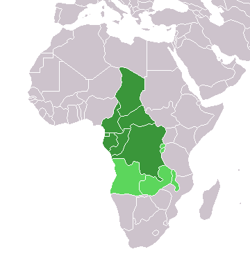
Map of countries in Central Africa.
This map was made by w:User:Joy and originally uploaded to the English Wikipedia as Africa-central-countries.png at 01:32, 28 March 2004. It is a modification of Image:BlankMap-World.png.

|
Toestemming word verleen tot die kopiëring, verspreiding en/of wysiging van hierdie dokument onder die voorwaardes van die GNU-lisensie vir vrye dokumentasie, weergawe 1.2 of enige latere weergawe uitgegee deur die Stigting vir Vrye Sagteware, sonder Invariante Dele, geen Voorbladtekste en geen Agterbladtekste. 'n Kopie van hierdie lisensie is ingesluit in die afdeling getiteld GNU Free Documentation License. |
| Hierdie lêer is gelisensieer onder die Creative Commons Erkenning-Insgelyks Deel 3.0 Onoorgedraagde lisensie. | ||
| ||
| This licensing tag was added to this file as part of the GFDL licensing update. |
Lêergeskiedenis
Klik op die datum/tyd om te sien hoe die lêer destyds gelyk het.
| Datum/Tyd | Duimnael | Dimensies | Gebruiker | Opmerking | |
|---|---|---|---|---|---|
| huidig | 18:21, 17 Maart 2018 | | 360 × 392 (10 KG) | Maphobbyist | Montenegro border |
| 18:06, 13 Januarie 2014 |  | 360 × 392 (10 KG) | VVVF | Some corrections | |
| 19:52, 9 Julie 2011 |  | 360 × 392 (13 KG) | Maphobbyist | South Sudan has become independent on July 9, 2011. Sudan and South Sudan are shown with the new international border between them. | |
| 11:10, 5 Mei 2006 |  | 360 × 392 (4 KG) | Hautala | optimized with png | |
| 18:30, 29 April 2005 |  | 360 × 392 (14 KG) | ChongDae | from en:Image:Africa-countries-central.png {{GFDL}} Category:Maps of Africa |
Lêergebruik
Daar is geen bladsye wat dié lêer gebruik nie.
Globale lêergebruik
Die volgende ander wiki's gebruik hierdie lêer:
- Gebruik in fr.wikipedia.org
- Gebruik in he.wikipedia.org
- Gebruik in ht.wikipedia.org
- Gebruik in incubator.wikimedia.org
- Gebruik in is.wikipedia.org
- Gebruik in is.wiktionary.org
- Gebruik in kaa.wikipedia.org
- Gebruik in kbd.wikipedia.org
- Gebruik in ko.wikipedia.org
- Gebruik in ky.wikipedia.org
- Gebruik in mg.wikipedia.org
- Gebruik in nl.wikipedia.org
- Gebruik in nn.wikipedia.org
- Gebruik in oc.wikipedia.org
- Gebruik in pl.wikipedia.org
- Gebruik in ru.wikipedia.org
- Gebruik in sl.wikipedia.org
- Gebruik in sv.wikipedia.org
- Gebruik in sv.wikinews.org
- Gebruik in szl.wikipedia.org
- Gebruik in tk.wikipedia.org
- Gebruik in tt.wikipedia.org
- Gebruik in uk.wikipedia.org
- Gebruik in uz.wikipedia.org
- Gebruik in wo.wikipedia.org
- Gebruik in yi.wikipedia.org