
Lêer:Arctic Ocean location map.svg

Size of this PNG preview of this SVG file: 600 × 599 piksels. Ander resolusies: 240 × 240 piksels | 481 × 480 piksels | 769 × 768 piksels | 1 025 × 1 024 piksels | 2 051 × 2 048 piksels | 709 × 708 piksels.
Oorspronklike lêer (SVG-lêer, normaalweg 709 × 708 piksels, lêergrootte: 589 KG)
Opsomming
| Beskrywing |
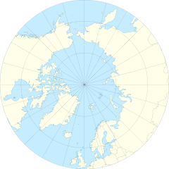
English: Location Map of the Arctic Ocean
|
| Datum | |
| Bron | Eie werk |
| Outeur | Tentotwo |
| Ander weergawes |
|

Lisensiëring
Ek, die outeursreghouer van hierdie werk, publiseer dit onder die volgende lisensie:
Hierdie lêer is gelisensieer onder die Creative Commons Erkenning-Insgelyks Deel 3.0 Onoorgedraagde lisensie.
- U is vry:
- om te deel – die werk kopieer, versprei en deurgee
- om te hermeng – om die werk aan te pas
- Onder die volgende voorwaardes:
- naamsvermelding – U moet die nodige krediet gee, 'n skakel na die lisensie verskaf en aandui of daar veranderinge aangebring is. U mag dit op enige redelike manier doen, maar nie op enige manier wat daarop dui dat die lisensiegewer u of u gebruik onderskryf nie.
- insgelyks – As u die materiaal hermix, transformeer of voortbou, moet u u bydraes versprei onder die dieselfde of versoenbare lisensie as die oorspronklike.
Shell script for generating the map using GMT archive copy at the Wayback Machine
#!/bin/sh

# Set common options
PROJECTION=E0.0/90.0/20.0c
REGION=-180/180/50/90
FILENAME=arctic_ocean.ps

# Get Natural Earth datafiles
echo "Downloading datafiles from naturalearthdata.com"
wget -nv -nc \
 http://www.naturalearthdata.com/http//www.naturalearthdata.com/download/50m/physical/50m-coastline.zip\
 http://www.naturalearthdata.com/http//www.naturalearthdata.com/download/50m/physical/50m-land.zip\
 http://www.naturalearthdata.com/http//www.naturalearthdata.com/download/50m/cultural/50m-admin-0-boundary-lines.zip
echo "...done\n"

echo "Inflating archives"
unzip 50m\*.zip
echo "...done\n"

echo "Converting shapefiles to GMT"
ogr2ogr -F GMT 50m_land.gmt 50m_land.shp
ogr2ogr -F GMT 50m_coastline.gmt 50m_coastline.shp
ogr2ogr -F GMT 50m_borders.gmt ne_50m_admin_0_boundary_lines_land.shp
echo "...done\n"

echo "Creating maps"
GMT psxy -m -J$PROJECTION -R$REGION -Bg15 --POLAR_CAP=none --BASEMAP_TYPE=plain --BASEMAP_AXES=WeS 50m_land.gmt -K -G254/254/233 > $FILENAME
GMT psxy -m -J$PROJECTION -R$REGION 50m_coastline.gmt -O -K -W9/120/171  >> $FILENAME
GMT psxy -m -J$PROJECTION -R$REGION 50m_borders.gmt -O -W100/100/100  >> $FILENAME
echo "...done\n"

echo "You can now open $FILENAME in Inkscape to clean up the file and save it as SVG. You should add an ocean coloured background and simplify the graticules using CTRL+L."
Lêergeskiedenis
Klik op die datum/tyd om te sien hoe die lêer destyds gelyk het.
| Datum/Tyd | Duimnael | Dimensies | Gebruiker | Opmerking | |
|---|---|---|---|---|---|
| huidig | 11:54, 27 Januarie 2012 | | 709 × 708 (589 KG) | Tentotwo |
Lêergebruik
Die volgende bladsy gebruik dié lêer:
Globale lêergebruik
Die volgende ander wiki's gebruik hierdie lêer:
- Gebruik in ar.wikipedia.org
- Gebruik in ast.wikipedia.org
- Polu Norte
- Islla de la Soledá
- Adventfjorden
- Isfjorden
- Estrechu de Davis
- Aeropuertu de Jan Mayen
- Aeropuertu de Svalbard
- Módulu:Mapa de llocalización/datos/Árticu/usu
- Módulu:Mapa de llocalización/datos/Árticu
- Kvitøya
- Kükenthaløya
- Nordaustlandet
- Wilhelmøya
- Austfonna
- Storøya
- Estrechu d'Hinlopen
- Ny-Friesland
- Sorgfjorden
- Verlegenhuken
- Wahlbergøya
- Advent City
- Pyramiden
- Hiorthhamn
- Isfjord Radio
- Gebruik in az.wikipedia.org
- Gebruik in ban.wikipedia.org
- Gebruik in bcl.wikipedia.org
- Gebruik in ceb.wikipedia.org
- Gebruik in ce.wikipedia.org
- Gebruik in cs.wikipedia.org
- Gebruik in de.wikipedia.org
Wys meer globale gebruik van die lêer.