
Lêer:Brazil State Amazonas.svg

Oorspronklike lêer (SVG-lêer, normaalweg 702 × 687 piksels, lêergrootte: 676 KG)

|
Standardization of derivative maps
Feel free to create derivations of this work, but if you want to illustrate a Wikipedia article with derivative works of this or similar maps of Brazil, please strictly follow the visual standard, nomenclature and classification already in use. All maps of Brazilian subdivisions are being adaptated or created in this way. We do not want to inhibit creativity but the pattern adopted here was presented and accepted by the Lusophone community and should be followed whenever possible. |
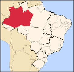
| Beskrywing | Map locator of Brazil's Amazonas state | ||||||||
| Datum | |||||||||
| Bron | Eie werk | ||||||||
| Outeur | Raphael Lorenzeto de Abreu | ||||||||
| Toestemming (Hergebruik van die lêer) |
Ek, die outeursreghouer van hierdie werk, publiseer dit onder die volgende lisensie:
This file is licensed under the Creative Commons Attribution 2.5 Generic license.
U kan die lisensie van u keuse kies. |
||||||||
| Ander weergawes | Derivative works of this file: Distribution of Schlumbergera.png |

Lêergeskiedenis
Klik op die datum/tyd om te sien hoe die lêer destyds gelyk het.
| Datum/Tyd | Duimnael | Dimensies | Gebruiker | Opmerking | |
|---|---|---|---|---|---|
| huidig | 03:07, 3 Junie 2006 | | 702 × 687 (676 KG) | Raphael.lorenzeto | |
| 02:51, 3 Junie 2006 |  | 702 × 687 (676 KG) | Raphael.lorenzeto | ||
| 09:30, 25 April 2006 |  | 702 × 687 (448 KG) | Raphael.lorenzeto | {{Information| |Description=Map locator of Brazil's Amazonas state |Source=own work |Date=April, 23 2006 |Author=Raphael Lorenzeto de Abreu |Permission={{self2|GFDL|cc-by-2.5}} |other_versions= }} Category:Maps of Amazonas Category:Maps of Brazil |
Lêergebruik
Die volgende 2 bladsye gebruik dié lêer:
Globale lêergebruik
Die volgende ander wiki's gebruik hierdie lêer:
- Gebruik in ang.wikipedia.org
- Gebruik in be-tarask.wikipedia.org
- Gebruik in be.wikipedia.org
- Gebruik in bg.wikipedia.org
- Gebruik in bpy.wikipedia.org
- Gebruik in bs.wikipedia.org
- Gebruik in da.wikipedia.org
- Gebruik in de.wikipedia.org
- Gebruik in en.wikipedia.org
- Amazonas (Brazilian state)
- Manaus
- Tabatinga
- Tefé
- Parintins
- São Gabriel da Cachoeira
- Manacapuru
- Coari
- Lábrea
- List of municipalities in Amazonas
- Santo Antônio do Içá
- São Paulo de Olivença
- Alvarães, Amazonas
- Amaturá
- Anamã
- Anori
- Apuí
- Atalaia do Norte
- Autazes
- Barcelos, Amazonas
- Barreirinha
- Benjamin Constant, Amazonas
- Beruri
- Boa Vista do Ramos
- Boca do Acre
- Borba, Amazonas
- Caapiranga
- Canutama
- Carauari
- Careiro
- Careiro da Várzea
Wys meer globale gebruik van die lêer.