
Lêer:Dun laoghaire obelisk.jpg

Grootte van hierdie voorskou: 800 × 533 piksels. Ander resolusies: 320 × 213 piksels | 640 × 427 piksels | 1 024 × 683 piksels | 1 280 × 853 piksels | 2 048 × 1 365 piksels.
Oorspronklike lêer (2 048 × 1 365 piksels, lêergrootte: 1,09 MG, MIME-tipe: image/jpeg)
Opsomming
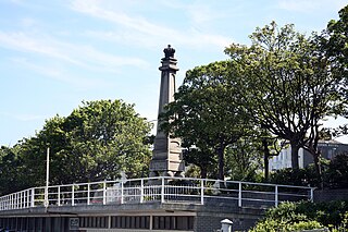
| Beskrywing | Dun Laoghaire is a very historical town. It used to be a small fishing village located on a rocky coast near Salthill, which was renowned for its production of salt. The original village, called Dunleary was situated near the beginning of the present West Pier. The present inner harbour, known as the coal harbour, dates from that time of the 18th Century. It consisted of seventy dwellings or cottages and was a very compact little village. All that remains of Dunleary is a row of 15 houses, including ‘Purty Kitchen’ and the Coal Harbour Pier. However, during that time, there was also another pier which was in the form of a curve. That pier is now buried beneath the railway line. There used to be a sandy cove running up to the site of the former ‘Fun Factory’, which was closed recently. Now, all that land has been reclaimed and built on. In Dunleary during the 18th Century, there used to be a famous coffeehouse which was very popular with tourists and people on day-trips from Dublin. The small harbour used to dry-out at low tide but it was considered an important departure point for England. Dun Laoghaire is still an important port, however the present journey time of 1½ hours does not compare to the 22 hours then! |
| Datum | |
| Bron | DUN LAOGHAIRE |
| Outeur | William Murphy from Dublin, Ireland |
Lisensiëring
This file is licensed under the Creative Commons Attribution-Share Alike 2.0 Generic license.
- U is vry:
- om te deel – die werk kopieer, versprei en deurgee
- om te hermeng – om die werk aan te pas
- Onder die volgende voorwaardes:
- naamsvermelding – U moet die nodige krediet gee, 'n skakel na die lisensie verskaf en aandui of daar veranderinge aangebring is. U mag dit op enige redelike manier doen, maar nie op enige manier wat daarop dui dat die lisensiegewer u of u gebruik onderskryf nie.
- insgelyks – As u die materiaal hermix, transformeer of voortbou, moet u u bydraes versprei onder die dieselfde of versoenbare lisensie as die oorspronklike.
| This image was originally posted to Flickr by infomatique at https://www.flickr.com/photos/80824546@N00/190196802. It was reviewed on 24 Mei 2007 by FlickreviewR and was confirmed to be licensed under the terms of the cc-by-sa-2.0. |
Lêergeskiedenis
Klik op die datum/tyd om te sien hoe die lêer destyds gelyk het.
| Datum/Tyd | Duimnael | Dimensies | Gebruiker | Opmerking | |
|---|---|---|---|---|---|
| huidig | 08:39, 24 Mei 2007 | | 2 048 × 1 365 (1,09 MG) | Kanchelskis | {{Information |Description= Dun Laoghaire is a very historical town. It used to be a small fishing village located on a rocky coast near Salthill, which was renowned for its production of salt. The original village, called Dunleary was situated near the b |
Lêergebruik
Die volgende bladsy gebruik dié lêer:
Globale lêergebruik
Die volgende ander wiki's gebruik hierdie lêer:
- Gebruik in en.wikipedia.org
- Gebruik in es.wikipedia.org
- Gebruik in it.wikipedia.org