
Lêer:EEZ France.png
Grootte van hierdie voorskou: 800 × 391 piksels. Ander resolusies: 320 × 156 piksels | 640 × 313 piksels | 1 024 × 501 piksels | 1 280 × 626 piksels | 2 410 × 1 178 piksels.
Oorspronklike lêer (2 410 × 1 178 piksels, lêergrootte: 317 KG, MIME-tipe: image/png)
Opsomming

|
File:Territorial waters - France.svg is a vector version of this file. It should be used in place of this PNG file.
File:EEZ France.png → File:Territorial waters - France.svg
For more information, see Help:SVG. |
 |
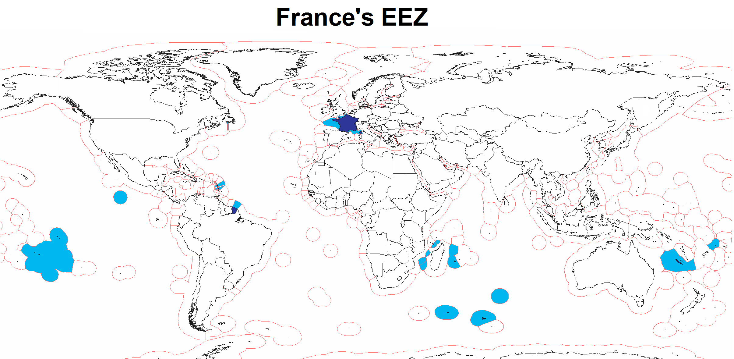
| Beskrywing | Map of France's Exclusive Economic Zone |
| Datum | |
| Bron | Eie werk |
| Outeur | Godefroy |
| Ander weergawes | Derivative works of this file: WorldEEZ.png |
Lisensiëring
Ek, die outeursreghouer van hierdie werk, publiseer dit onder die volgende lisensie:

|
Toestemming word verleen tot die kopiëring, verspreiding en/of wysiging van hierdie dokument onder die voorwaardes van die GNU-lisensie vir vrye dokumentasie, weergawe 1.2 of enige latere weergawe uitgegee deur die Stigting vir Vrye Sagteware, sonder Invariante Dele, geen Voorbladtekste en geen Agterbladtekste. 'n Kopie van hierdie lisensie is ingesluit in die afdeling getiteld GNU Free Documentation License. |
| Hierdie lêer is gelisensieer onder die Creative Commons Erkenning-Insgelyks Deel 3.0 Onoorgedraagde lisensie. | ||
| ||
| This licensing tag was added to this file as part of the GFDL licensing update. |
U kan die lisensie van u keuse kies.
Lêergeskiedenis
Klik op die datum/tyd om te sien hoe die lêer destyds gelyk het.
| Datum/Tyd | Duimnael | Dimensies | Gebruiker | Opmerking | |
|---|---|---|---|---|---|
| huidig | 14:45, 25 Julie 2020 | | 2 410 × 1 178 (317 KG) | Maphobbyist | Added the borders of South Sudan and Montengro, and the Sea of Okhotsk is now wholly within the Russian EEZ. |
| 05:16, 3 Februarie 2010 |  | 2 410 × 1 178 (289 KG) | Insider | little correction | |
| 15:33, 17 Maart 2008 |  | 2 410 × 1 178 (183 KG) | Godefroy~commonswiki | {{Information |Description=Map of France's EEZ |Source=self-made |Date=March 17, 2008 |Author= Godefroy |Permission= |other_versions= }} |
Lêergebruik
Daar is geen bladsye wat dié lêer gebruik nie.
Globale lêergebruik
Die volgende ander wiki's gebruik hierdie lêer:
- Gebruik in en.wikibooks.org
- Gebruik in fr.wikipedia.org
- Gebruik in fr.wikiversity.org
- Gebruik in hy.wikipedia.org
- Gebruik in id.wikipedia.org
- Gebruik in it.wikipedia.org
- Gebruik in kn.wikipedia.org
- Gebruik in mk.wikipedia.org
- Gebruik in nn.wikipedia.org
- Gebruik in ro.wikibooks.org
- Gebruik in te.wikipedia.org
- Gebruik in www.wikidata.org