
Lêer:Falkland Islands location map.svg

Size of this PNG preview of this SVG file: 737 × 600 piksels. Ander resolusies: 295 × 240 piksels | 590 × 480 piksels | 944 × 768 piksels | 1 258 × 1 024 piksels | 2 516 × 2 048 piksels | 1 134 × 923 piksels.
Oorspronklike lêer (SVG-lêer, normaalweg 1 134 × 923 piksels, lêergrootte: 138 KG)
Opsomming
| Beskrywing |
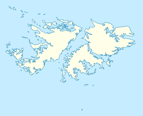
Deutsch: Positionskarte der Falklandinseln
Quadratische Plattkarte, N-S-Streckung 155 %. Geographische Begrenzung der Karte:
English: Location map of the Falkland Islands
Equirectangular projection, N/S stretching 155 %. Geographic limits of the map:
|
|||||||||
| Datum | ||||||||||
| Bron | own work, using United States National Imagery and Mapping Agency data | |||||||||
| Skepper | ||||||||||
| Geotemporal data | ||||||||||
| Bounding box |
|
|||||||||
| Georeferencing | If inappropriate please set warp_status = skip to hide. | |||||||||
| Ander weergawes |
Derivative works of this file: |
|||||||||

|
This map has been made or improved in the German Kartenwerkstatt (Map Lab). You can propose maps to improve as well.
|
Lisensiëring
Ek, die outeursreghouer van hierdie werk, publiseer dit onder die volgende lisensie:

|
Toestemming word verleen tot die kopiëring, verspreiding en/of wysiging van hierdie dokument onder die voorwaardes van die GNU-lisensie vir vrye dokumentasie, weergawe 1.2 of enige latere weergawe uitgegee deur die Stigting vir Vrye Sagteware, sonder Invariante Dele, geen Voorbladtekste en geen Agterbladtekste. 'n Kopie van hierdie lisensie is ingesluit in die afdeling getiteld GNU Free Documentation License. |
This file is licensed under the Creative Commons Attribution 3.0 Unported license.
- U is vry:
- om te deel – die werk kopieer, versprei en deurgee
- om te hermeng – om die werk aan te pas
- Onder die volgende voorwaardes:
- naamsvermelding – U moet die nodige krediet gee, 'n skakel na die lisensie verskaf en aandui of daar veranderinge aangebring is. U mag dit op enige redelike manier doen, maar nie op enige manier wat daarop dui dat die lisensiegewer u of u gebruik onderskryf nie.
U kan die lisensie van u keuse kies.
Lêergeskiedenis
Klik op die datum/tyd om te sien hoe die lêer destyds gelyk het.
| Datum/Tyd | Duimnael | Dimensies | Gebruiker | Opmerking | |
|---|---|---|---|---|---|
| huidig | 12:00, 15 Maart 2009 | | 1 134 × 923 (138 KG) | NordNordWest | {{Information |Description= {{de|Positionskarte der Falklandinseln}} Quadratische Plattkarte, N-S-Streckung 155 %. Geographische Begrenzung der Karte: * N: 50.9° S * S: 53.0° S * W: 61.5° W * O: 57.5° W {{en|Location map of the |
Lêergebruik
Die volgende bladsy gebruik dié lêer:
Globale lêergebruik
Die volgende ander wiki's gebruik hierdie lêer:
- Gebruik in an.wikipedia.org
- Gebruik in ar.wikipedia.org
- Gebruik in ast.wikipedia.org
- Gebruik in az.wikipedia.org
- Gebruik in ba.wikipedia.org
- Gebruik in be-tarask.wikipedia.org
- Gebruik in be.wikipedia.org
- Gebruik in bg.wikipedia.org
- Gebruik in bn.wikipedia.org
- Gebruik in ca.wikipedia.org
- Gebruik in ceb.wikipedia.org
- Plantilya:Location map United Kingdom Falkland Islands
- William Point
- Sandy Island
- Saddle Hill
- Rat Island
- Rabbit Island
- Low Bay
- Long Island
- Green Island
- Green Islet
- Goat Point
- Castle Hill
- Bird Island
- Mount Pleasant
- North Point
- Hospital Point
- Castle Rock
- West Point
- Little Island
- Black Point
- North Beach
- Sail Rock
- Black Rock
- High Rock
- Hut Point
- East Point
- Wolf Rock
- White Rock
- White Point
- Whale Point
- Spring Point
Wys meer globale gebruik van die lêer.