
Lêer:Globdisttornado.jpg
Grootte van hierdie voorskou: 800 × 429 piksels. Ander resolusies: 320 × 172 piksels | 640 × 344 piksels | 1 024 × 550 piksels | 1 280 × 687 piksels | 2 729 × 1 465 piksels.
Oorspronklike lêer (2 729 × 1 465 piksels, lêergrootte: 348 KG, MIME-tipe: image/jpeg)

|
This map of the world image could be re-created using vector graphics as an SVG file. This has several advantages; see Commons:Media for cleanup for more information. If an SVG form of this image is available, please upload it and afterwards replace this template with
{{vector version available|new image name}}.
It is recommended to name the SVG file “Globdisttornado.svg”—then the template Vector version available (or Vva) does not need the new image name parameter. |


Opsomming
| Beskrywing |
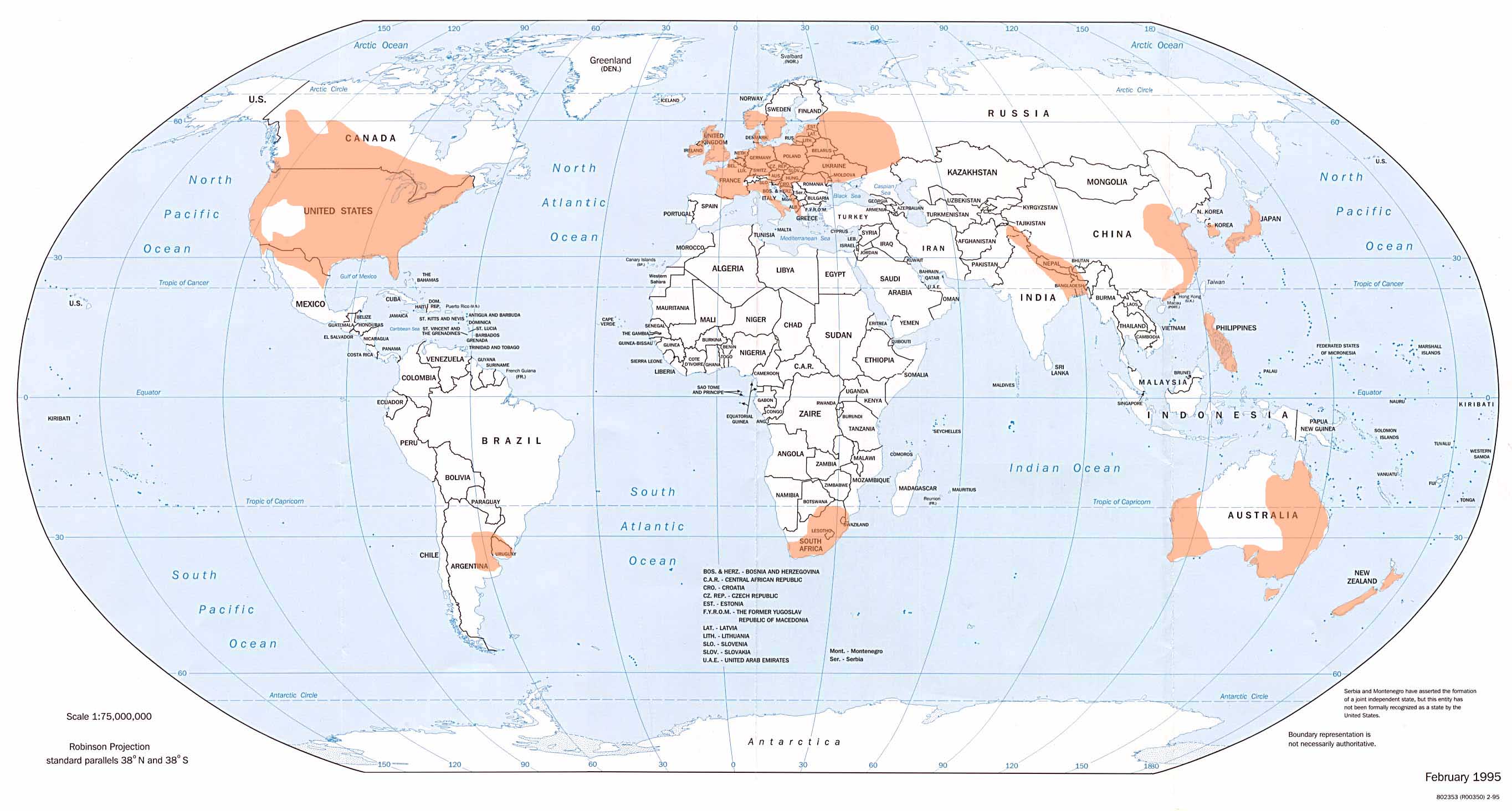
English: Shows where tornadoes are most likely to occur. From the website of the National Climatic Data Center, Asheville, North Carolina, USA. |
| Datum | |
| Bron |
ncdc.noaa.gov/img/climate/research/tornado/globdist.jpg ncdc.noaa.gov/oa/climate/severeweather/tornadoes.html |
| Outeur | National Oceanic and Atmospheric Administration (NOAA) |
Lisensiëring
This image is in the public domain because it contains materials that originally came from the U.S. National Oceanic and Atmospheric Administration, taken or made as part of an employee's official duties.
|
Lêergeskiedenis
Klik op die datum/tyd om te sien hoe die lêer destyds gelyk het.
| Datum/Tyd | Duimnael | Dimensies | Gebruiker | Opmerking | |
|---|---|---|---|---|---|
| huidig | 20:22, 13 Maart 2008 | | 2 729 × 1 465 (348 KG) | Runningonbrains | ==Summary== Shows where tornadoes are most likely to occur. From the website of the National Climatic Data, Asheville, North Carolina, http://www.ncdc.noaa.gov/oa/climate/severeweather/tornadoes.html Image location: http://www.ncdc.noa |
Lêergebruik
Die volgende bladsy gebruik dié lêer:
Globale lêergebruik
Die volgende ander wiki's gebruik hierdie lêer:
- Gebruik in ast.wikipedia.org
- Gebruik in ba.wikipedia.org
- Gebruik in cs.wikipedia.org
- Gebruik in el.wikipedia.org
- Gebruik in en.wikipedia.org
- Gebruik in en.wikibooks.org
- Gebruik in es.wikipedia.org
- Gebruik in fa.wikipedia.org
- Gebruik in fr.wikipedia.org
- Gebruik in gl.wikipedia.org
- Gebruik in hu.wikipedia.org
- Gebruik in id.wikipedia.org
- Gebruik in it.wikipedia.org
- Gebruik in ja.wikipedia.org
- Gebruik in ko.wikipedia.org
- Gebruik in lv.wikipedia.org
- Gebruik in pl.wikipedia.org
- Gebruik in ru.wikipedia.org
- Gebruik in smn.wikipedia.org
- Gebruik in uk.wikipedia.org