
Lêer:Map of Montreal 1744.jpg
Grootte van hierdie voorskou: 755 × 600 piksels. Ander resolusies: 302 × 240 piksels | 604 × 480 piksels | 867 × 689 piksels.
Oorspronklike lêer (867 × 689 piksels, lêergrootte: 184 KG, MIME-tipe: image/jpeg)
Opsomming
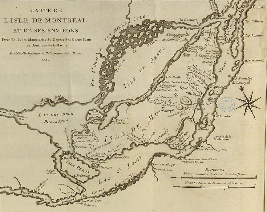
| Beskrywing | Map of the island of Montréal and surrounding area | |||||||||||||||||||
| Datum | ||||||||||||||||||||
| Bron |
|
|||||||||||||||||||
| Outeur |
|
|||||||||||||||||||
| Toestemming (Hergebruik van die lêer) |
See National Archives of Canada Copyright policy | |||||||||||||||||||
| Ander weergawes |
 |
|||||||||||||||||||

IST DOCH QUATSCH
Lisensiëring
|
This work is in the public domain in its country of origin and other countries and areas where the copyright term is the author's life plus 100 years or fewer. | |
| Hierdie lêer is geïdentifiseer as vry van bekende beperkings onder kopiereg, insluitend alle verwante en naburige regte. | |
Lêergeskiedenis
Klik op die datum/tyd om te sien hoe die lêer destyds gelyk het.
| Datum/Tyd | Duimnael | Dimensies | Gebruiker | Opmerking | |
|---|---|---|---|---|---|
| huidig | 23:26, 1 April 2008 | | 867 × 689 (184 KG) | Finavon | border cropped |
| 22:44, 2 April 2007 |  | 1 000 × 759 (199 KG) | Soul scanner~commonswiki | == Summary == {{Information |Description = Map of the island of Montréal and surrounding area |Source = [http://www.champlain2004.org/html/06/0619_e.html National Archives of Canada] |Date = 1744 |Author = Jacques-Nicolas Bellin |Permission = [http://w |
Lêergebruik
Die volgende bladsy gebruik dié lêer:
Globale lêergebruik
Die volgende ander wiki's gebruik hierdie lêer:
- Gebruik in ca.wikipedia.org
- Gebruik in da.wikipedia.org
- Gebruik in de.wikipedia.org
- Gebruik in en.wikipedia.org
- Gebruik in es.wikipedia.org
- Gebruik in ja.wikipedia.org
- Gebruik in ru.wikipedia.org
- Gebruik in uk.wikipedia.org