
Lêer:USA Virgin Islands location map.svg

Size of this PNG preview of this SVG file: 570 × 599 piksels. Ander resolusies: 228 × 240 piksels | 457 × 480 piksels | 731 × 768 piksels | 974 × 1 024 piksels | 1 949 × 2 048 piksels | 787 × 827 piksels.
Oorspronklike lêer (SVG-lêer, normaalweg 787 × 827 piksels, lêergrootte: 51 KG)
Opsomming
| Beskrywing |
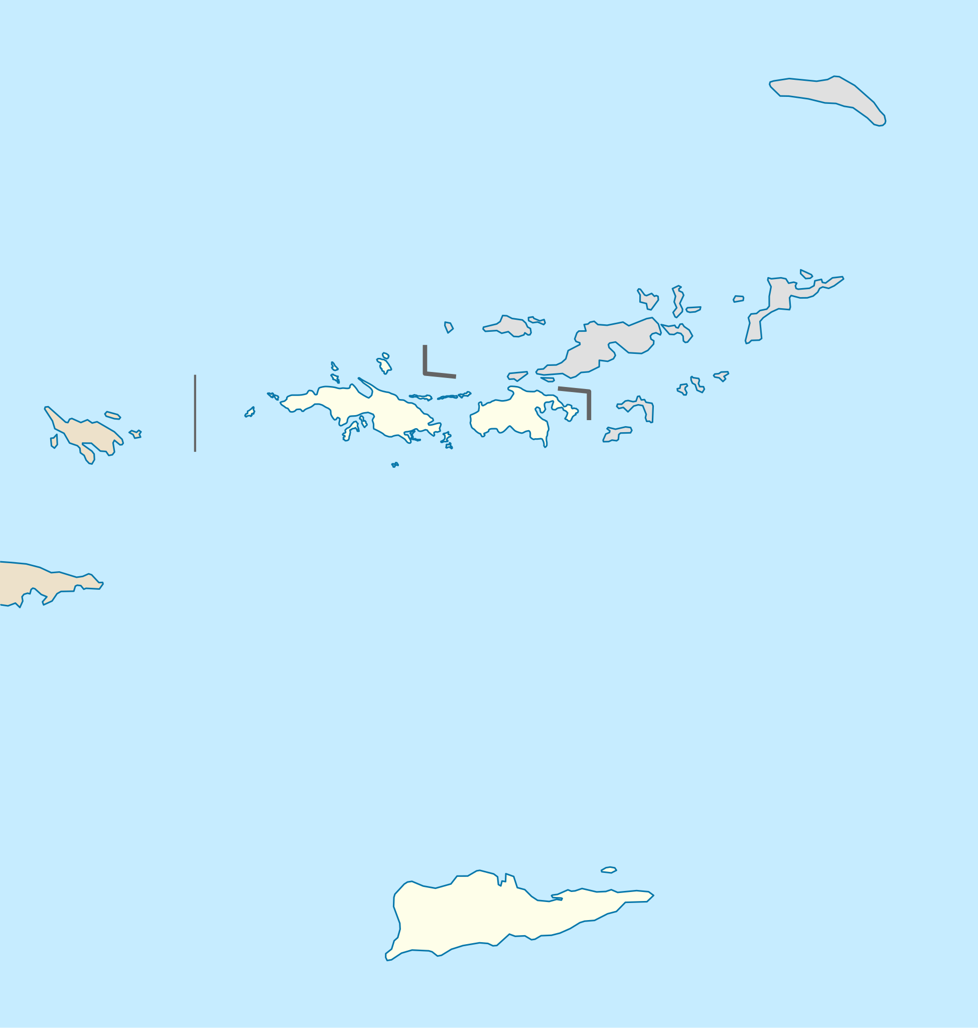
Quadratische Plattkarte, N-S-Streckung 105 %. Geographische Begrenzung der Karte:
Equirectangular projection, N/S stretching 105 %. Geographic limits of the map:
|
| Datum | |
| Bron |
own work, using
|
| Outeur | NordNordWest |
| Ander weergawes | Derivative works of this file: Popular footprint.png |

|
This map has been made or improved in the German Kartenwerkstatt (Map Lab). You can propose maps to improve as well.
|
Lisensiëring
Ek, die outeursreghouer van hierdie werk, publiseer dit onder die volgende lisensie:
Hierdie lêer is gelisensieer onder die Creative Commons Erkenning-Insgelyks Deel 3.0 Onoorgedraagde lisensie.
- U is vry:
- om te deel – die werk kopieer, versprei en deurgee
- om te hermeng – om die werk aan te pas
- Onder die volgende voorwaardes:
- naamsvermelding – U moet die nodige krediet gee, 'n skakel na die lisensie verskaf en aandui of daar veranderinge aangebring is. U mag dit op enige redelike manier doen, maar nie op enige manier wat daarop dui dat die lisensiegewer u of u gebruik onderskryf nie.
- insgelyks – As u die materiaal hermix, transformeer of voortbou, moet u u bydraes versprei onder die dieselfde of versoenbare lisensie as die oorspronklike.
Lêergeskiedenis
Klik op die datum/tyd om te sien hoe die lêer destyds gelyk het.
| Datum/Tyd | Duimnael | Dimensies | Gebruiker | Opmerking | |
|---|---|---|---|---|---|
| huidig | 17:03, 12 Julie 2009 | | 787 × 827 (51 KG) | NordNordWest | |
| 17:03, 12 Julie 2009 |  | 787 × 827 (51 KG) | NordNordWest | ||
| 09:41, 7 Julie 2009 |  | 787 × 827 (51 KG) | NordNordWest | {{Information |Description= {{de|Positionskarte der Amerikanischen Jungferninseln, USA}} Quadratische Plattkarte, N-S-Streckung 105 %. Geographische Begrenzung der Karte: * N: 18.85° N * S: 17.6° N * W: 6 |
Lêergebruik
Die volgende bladsy gebruik dié lêer:
Globale lêergebruik
Die volgende ander wiki's gebruik hierdie lêer:
- Gebruik in an.wikipedia.org
- Gebruik in ar.wikipedia.org
- Gebruik in arz.wikipedia.org
- Gebruik in ast.wikipedia.org
- Gebruik in az.wikipedia.org
- Gebruik in be-tarask.wikipedia.org
- Gebruik in be.wikipedia.org
- Gebruik in bg.wikipedia.org
- Gebruik in bn.wikipedia.org
- Gebruik in ceb.wikipedia.org
- Plantilya:Location map USA Virgin Islands
- Signal Hill
- Saint John
- The Narrows
- Long Bay
- Isaac Point
- Hughes Point
- Great Bay
- Mount Pleasant
- West Point
- West Cay
- Sandy Point
- Black Point
- Powell Point
- Sail Rock
- East Point
- White Point
- Whale Point
- Long Point
- Spring Point
- Fish Point
- Dog Rocks
- Sugar Bay
- Sandy Bay
- West End
- Southwest Point
- Salt Pond
- Salt Cay
- Pond Bay
- Flat Cays
- Pelican Cay
- Hurricane Hole
- Green Cay
- Porpoise Rocks
- French Bay
Wys meer globale gebruik van die lêer.