
Lêer:VOC Octrooigebied 1.jpg
Grootte van hierdie voorskou: 800 × 585 piksels. Ander resolusies: 320 × 234 piksels | 640 × 468 piksels | 1 024 × 749 piksels | 1 280 × 936 piksels | 2 268 × 1 659 piksels.
Oorspronklike lêer (2 268 × 1 659 piksels, lêergrootte: 626 KG, MIME-tipe: image/jpeg)
The official trade zone was indicated (several times) in the 1602 Charter of the VOC. That's why I suggest to add a link under "files" to the site where recently an English translation was published of that charter. www.australiaonthemap.org.au/content/view/50/59 AHS encourages this. Peter R the translator
Opsomming
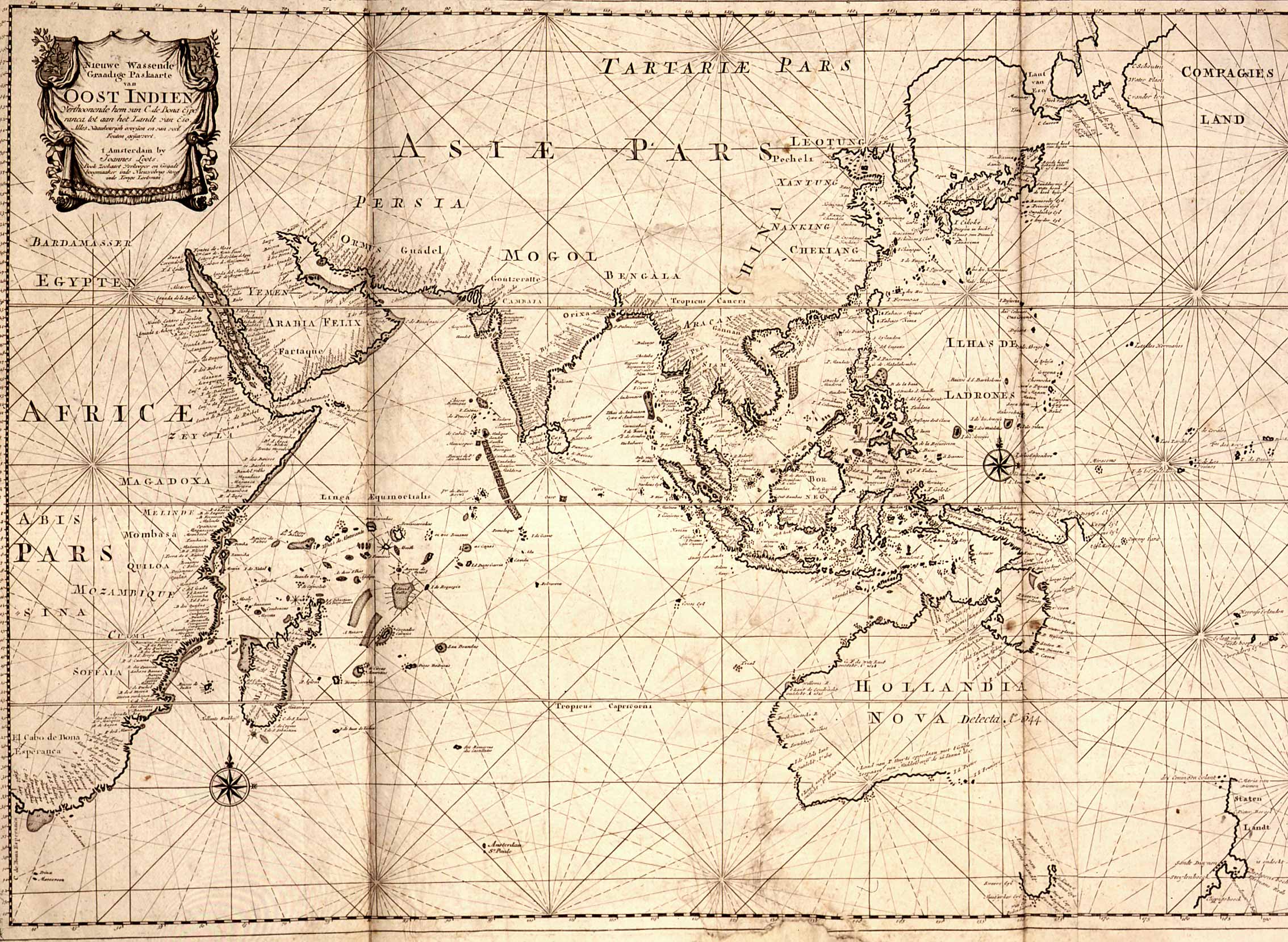
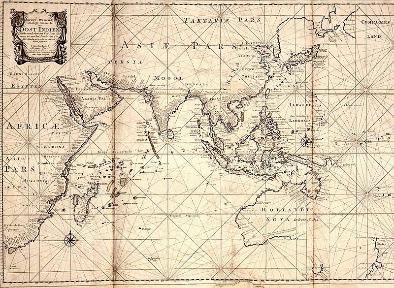
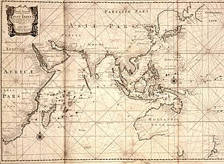
| Beskrywing | Map of the East Indies; the official trade zone (octrooigebied) of the VOC according to the VOC Charter, which was between Cape of Good Hope (South Africa) and Street Magallan (South America); printed c. 1700. |
| Datum | |
| Bron | TANAP |
| Outeur |
Lisensiëring
|
This work is in the public domain in its country of origin and other countries and areas where the copyright term is the author's life plus 100 years or fewer. | |
| Hierdie lêer is geïdentifiseer as vry van bekende beperkings onder kopiereg, insluitend alle verwante en naburige regte. | |
Lêergeskiedenis
Klik op die datum/tyd om te sien hoe die lêer destyds gelyk het.
| Datum/Tyd | Duimnael | Dimensies | Gebruiker | Opmerking | |
|---|---|---|---|---|---|
| huidig | 10:31, 3 Mei 2008 | | 2 268 × 1 659 (626 KG) | BoH | {{Information |Description=Map of the East Indies; the official trade zone (octrooigebied) of the VOC according to the VOC Charter, which was between Cape of Good Hope (South Africa) and Street Magallan (South America); printed c. 1700. |Source=[http://ww |
Lêergebruik
Die volgende bladsy gebruik dié lêer:
Globale lêergebruik
Die volgende ander wiki's gebruik hierdie lêer:
- Gebruik in en.wikipedia.org
- Gebruik in nl.wikipedia.org