
Lêer:Queen Elizabeth Islands 2009-08-27 (MODIS).jpg
Grootte van hierdie voorskou: 763 × 600 piksels. Ander resolusies: 306 × 240 piksels | 611 × 480 piksels | 978 × 768 piksels | 1 280 × 1 006 piksels | 2 560 × 2 011 piksels | 5 600 × 4 400 piksels.
Oorspronklike lêer (5 600 × 4 400 piksels, lêergrootte: 4,33 MG, MIME-tipe: image/jpeg)
| Beskrywing |
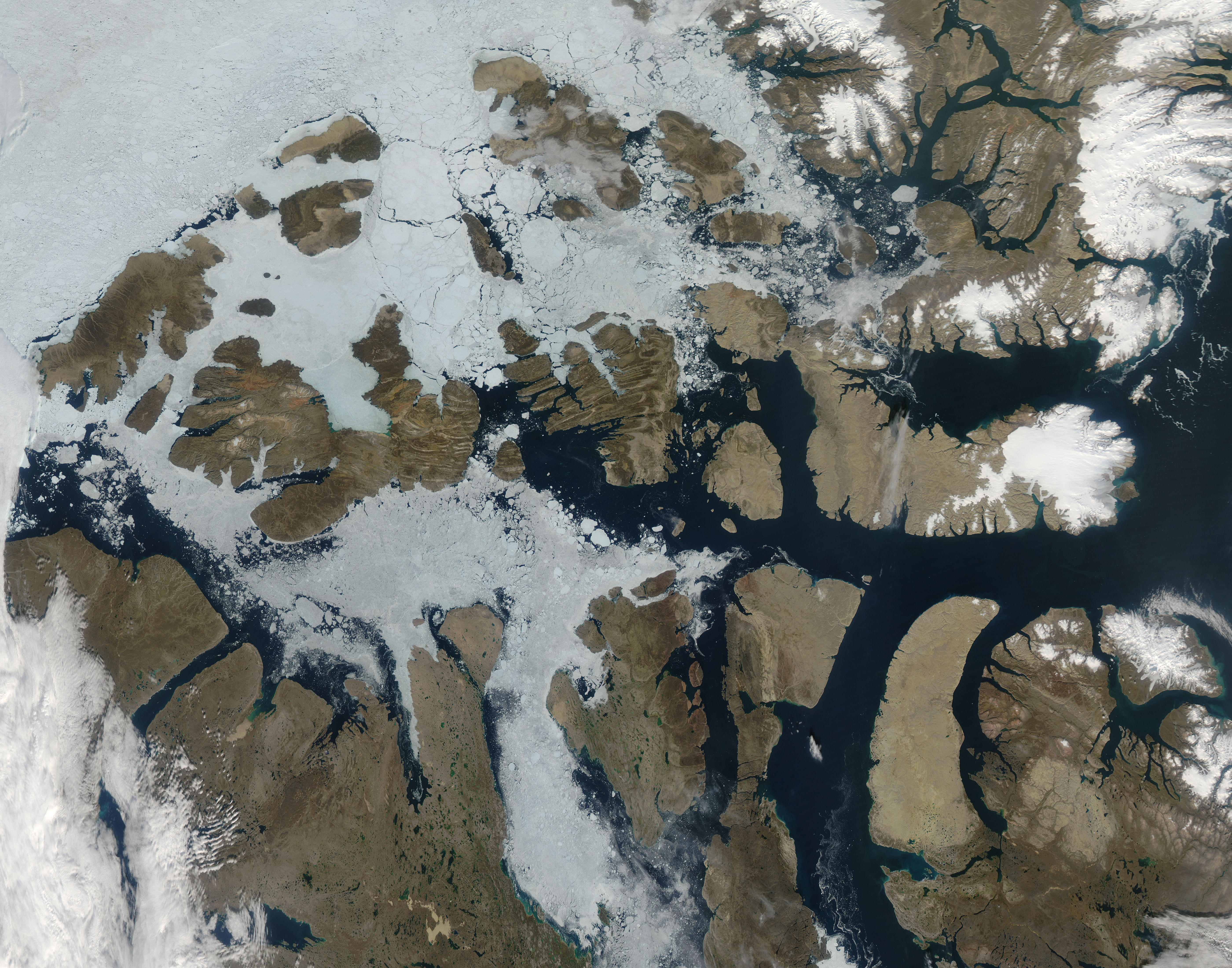
The fact that it is late summer is apparent in this image of the Queen Elizabeth Islands, located in northern Canada. This image was captured by the MODIS on the Aqua satellite on August 27, 2009. In past images of this region, captured in earlier months (i.e., May and June of 2001), the ice around the islands is shown just starting to break up. In this image from August, much of the ice is broken up and blue water is visible, as well as brown terrain. The Queen Elizabeth islands are the most northern group of islands in the Canadian Arctic Archipelago. This grouping used to be called the Parry Islands. After the name change in 1953, the Parry Islands only refers to the most southern part of the archipelago. The largest island is Ellesmere, located in the north, separated from Greenland by the Nares Strait. |
|||||
| Datum | ||||||
| Bron | http://modis.gsfc.nasa.gov/gallery/individual.php?db_date=2009-09-08 | |||||
| Outeur | Jeff Schmaltz MODIS Land Rapid Response Team, NASA GSFC | |||||
| Toestemming (Hergebruik van die lêer) |
|

.jpg)
Lêergeskiedenis
Klik op die datum/tyd om te sien hoe die lêer destyds gelyk het.
| Datum/Tyd | Duimnael | Dimensies | Gebruiker | Opmerking | |
|---|---|---|---|---|---|
| huidig | 20:16, 10 September 2009 | | 5 600 × 4 400 (4,33 MG) | Tryphon | {{Information |Description=The fact that it is late summer is apparent in this image of the en:Queen Elizabeth Islands, located in northern en:Canada. This image was captured by the en:MODIS on the en:Aqua satellite on August 27, 2 |
Lêergebruik
Die volgende bladsy gebruik dié lêer:
Globale lêergebruik
Die volgende ander wiki's gebruik hierdie lêer:
- Gebruik in ar.wikipedia.org
- Gebruik in ast.wikipedia.org
- Gebruik in ca.wikipedia.org
- Gebruik in ceb.wikipedia.org
- Gebruik in cy.wikipedia.org
- Gebruik in he.wikipedia.org
- Gebruik in hu.wikipedia.org
- Gebruik in it.wikipedia.org
- Gebruik in lv.wikipedia.org
- Gebruik in nn.wikipedia.org
- Gebruik in www.wikidata.org
.jpg)