
Lêer:Alexander-Island.jpg

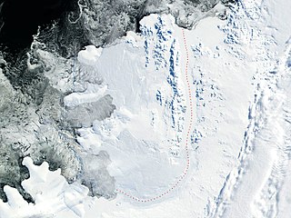
Grootte van hierdie voorskou: 799 × 599 piksels. Ander resolusies: 320 × 240 piksels | 640 × 480 piksels | 1 024 × 768 piksels | 1 280 × 960 piksels | 2 560 × 1 920 piksels | 2 869 × 2 152 piksels.
Oorspronklike lêer (2 869 × 2 152 piksels, lêergrootte: 4,02 MG, MIME-tipe: image/jpeg)
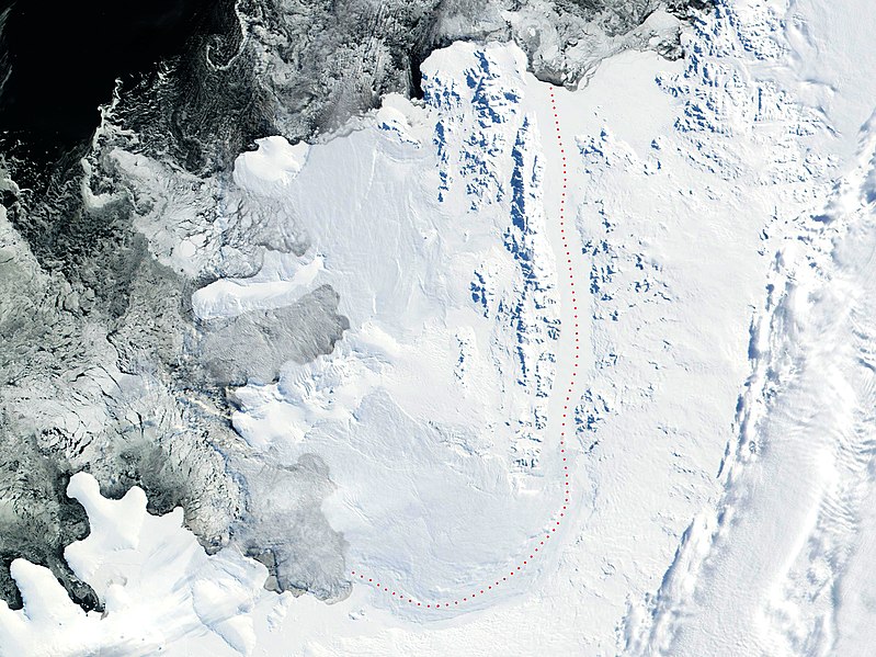
Source: 2002 NASA Visible Earth satellite image Bryan Coast, English Coast, Alexander Island, Fallieres Coast, and Bellingshausen Sea, Antarctica.
Fragment edited and published by Apcbg 13:29, 22 July 2006 (UTC).
| This file is in the public domain in the United States because it was solely created by NASA. NASA copyright policy states that "NASA material is not protected by copyright unless noted". (See Template:PD-USGov, NASA copyright policy page or JPL Image Use Policy.) | ||
 |
Warnings:
|
Lêergeskiedenis
Klik op die datum/tyd om te sien hoe die lêer destyds gelyk het.
| Datum/Tyd | Duimnael | Dimensies | Gebruiker | Opmerking | |
|---|---|---|---|---|---|
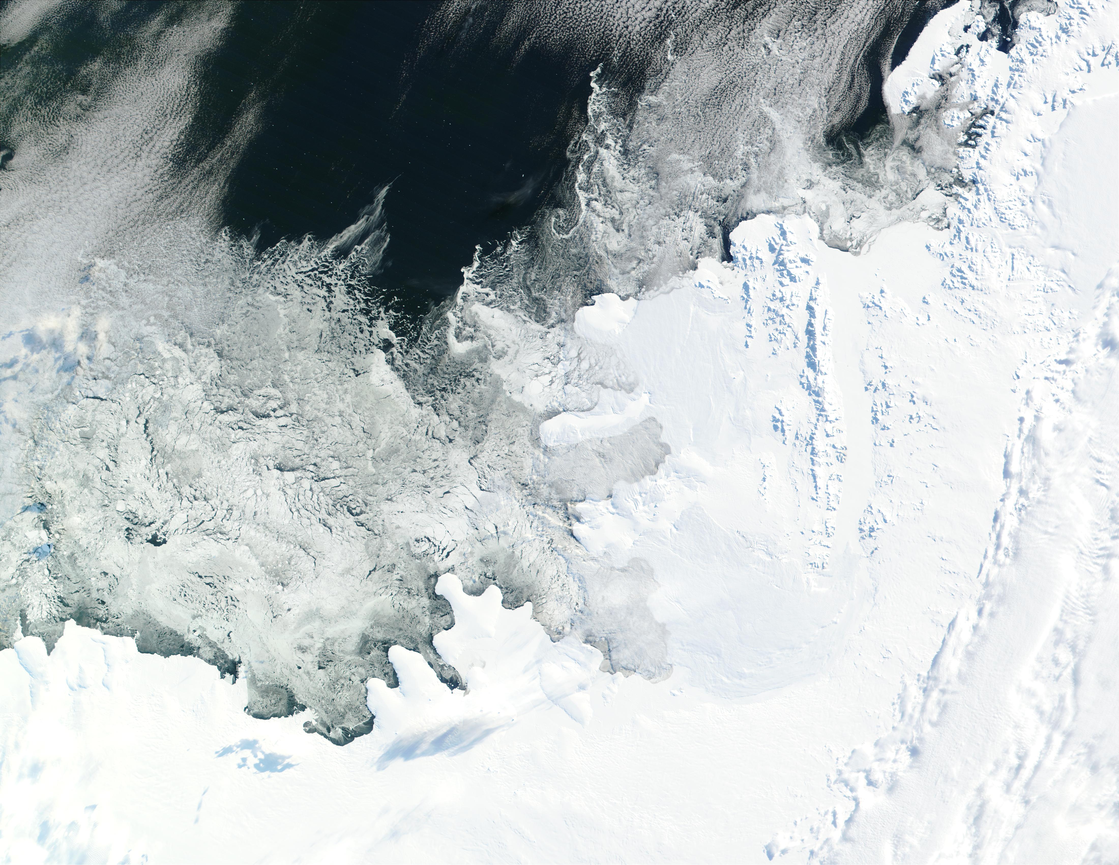
| huidig | 19:16, 30 Mei 2018 | | 2 869 × 2 152 (4,02 MG) | Apcbg | details |
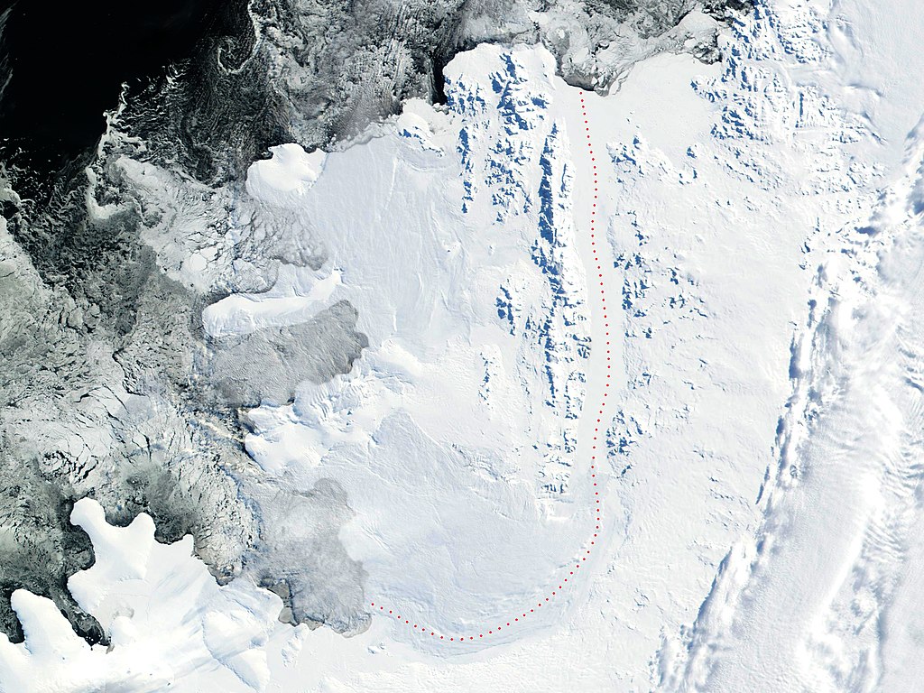
| 13:29, 22 Julie 2006 |  | 2 805 × 2 300 (4,23 MG) | Apcbg | 2002 NASA Visible Earth satellite image: Bryan Coast, English Coast, Alexander Island, Fallieres Coast, and Bellingshausen Sea, Antarctica. Fragment edited and published by ~~~~. {{nasa}} |
Lêergebruik
Die volgende bladsy gebruik dié lêer:
Globale lêergebruik
Die volgende ander wiki's gebruik hierdie lêer:
- Gebruik in ar.wikipedia.org
- Gebruik in be-tarask.wikipedia.org
- Gebruik in be.wikipedia.org
- Gebruik in ca.wikipedia.org
- Gebruik in da.wikipedia.org
- Gebruik in de.wikipedia.org
- Gebruik in en.wikipedia.org
- Alexander Island
- Umber Island
- Shaw Nunatak
- Thompson Hill
- Wubbold Glacier
- Stoltz Island
- Foreman Glacier
- Ablation Point – Ganymede Heights Antarctic Specially Protected Area
- Balgari Nunatak
- Satovcha Peak
- Igralishte Peak
- Mount Pontida
- Breze Peak
- Mount Devol
- Moriseni Peak
- Pripor Nunatak
- Lyubimets Nunatak
- Kandidiana Ridge
- Zavoy Nunatak
- Nebush Nunatak
- Tegra Nunatak
- Rachenitsa Nunatak
- Vola Ridge
- Lesnovo Hill
- Stryama Peak
- Paroriya Buttress
- Gazey Nunatak
- Piyanets Ridge
- Oselna Glacier
- Kolokita Cove
- Mozgovitsa Glacier
- Farmakida Cove
- Buneva Point
- Kamhi Point
- Goleminov Point
- Manolov Glacier
- St. Theodosius Nunatak
- Kutev Peak
- Nicolai Peak
- Pipkov Glacier
Wys meer globale gebruik van die lêer.